
Day 3: Taking It Easy to the Land of Enchantment
March 22, 2021
Day 1: Cutting Across California
March 20, 2021
Most recently updated on March 2, 2024
Driven on March 20, 2022
Originally posted on March 21, 2021
Ever heard of Fred Harvey?
Probably not, but his work is on display at three hotels we will visit today before settling in at another hotel famous for its ghost stories.
In between is a trip down memory lane along one of the nation’s most famous highways as well as a stop at one of the country’s most amazing natural wonders.
Day Two begins at the El Garces in Needles on the other side of town from the Wagon Wheel restaurant we discussed yesterday on Day 1.
The El Garces reopened a few years ago as a rental space for events inside what was once a historic former Harvey House hotel.
Fred Harvey made his fortune in the late 1800s building a chain of restaurants and hotels along the Atchison, Topeka and Santa Fe Railroad lines.
In coordination with the railroad, Harvey eventually opened 84 restaurants that catered to people riding the rails between Kansas and California. His theory was that travelers would enjoy a nice place to eat during stops on their trips.
His restaurants were known for fresh food and good service. He hired young women he called “Harvey Girls” as waitresses. The female employees were paid well and provided with room and board. However, they had to agree not to marry while they worked at the restaurants. The waitresses were so popular that a movie called “The Harvey Girls” starring Judy Garland was made in 1946.
After Harvey died in 1901, his sons took over the business operations.
When the railroads began to fade, the restaurants and hotels focused on motorists who were zipping along Route 66 and other new roadways.
The El Garces originally opened in 1908 as a hotel and restaurant. It was a considered a “crown jewel” in the Harvey chain due to its linen, silver, china and fresh flowers.
The hotel closed in 1949. Santa Fe Railroad used it for offices until 1988 before abandoning it.
The building was almost torn down until a local group convinced the city of Needles to purchase the facility in 1999. It was listed on the National Register of Historic Places in 2002.
Since then, the city has refurbished the complex as a “Harvey House Hotel.”
———————————–
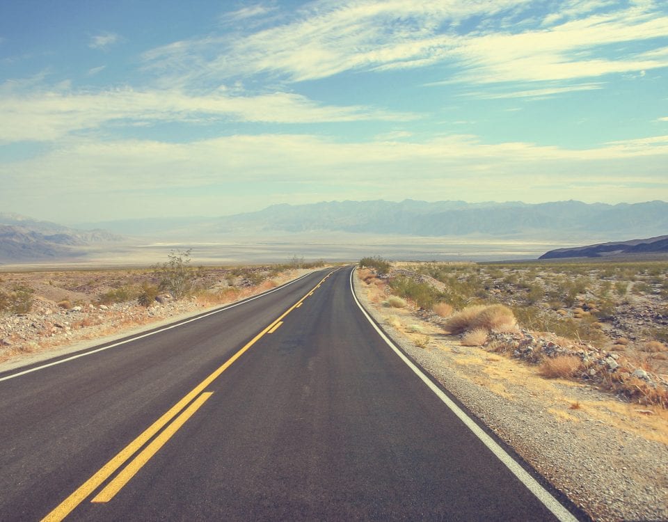
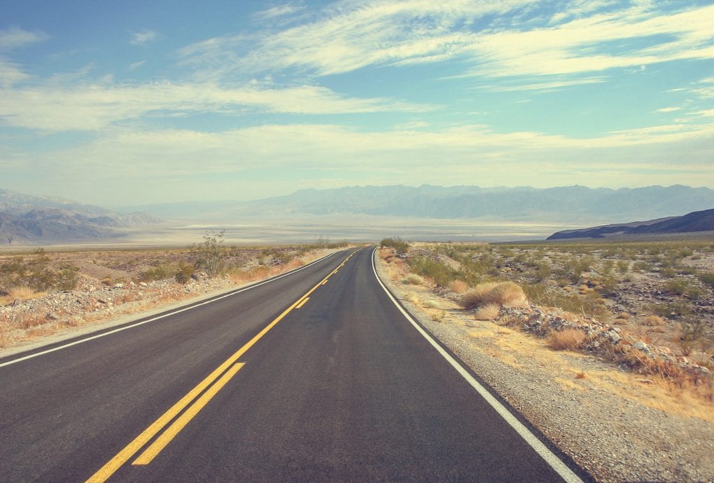
We head north out of town along the Needles Highway.
The road provides us with a nice view of the hard-working Colorado River.
The Colorado is the fifth longest river in the United States. It starts at 10,000 feet elevation in the mountains of Colorado and flows 1,450 miles through seven states as well as 23 Native American tribal lands and Mexico.
Along its route, the waterway crosses through three desert areas as well as the two driest states in the country – Nevada and Utah.
The river provides drinking water for more than 35 million people, including residents in Los Angeles, San Diego, Las Vegas and Phoenix.
The Colorado also helps irrigate 4 million acres of farmland and produces 12 billion kilowatt-hours of hydroelectric power per year.
The Colorado is in big demand. More water is exported from this waterway than any other river basin in the United States.
That’s become a problem. The demands of its users now outstrip the river basin’s annual output of 15 million acre-feet. That means in most years almost every drop of water in the river is used. In fact, the Colorado no longer makes it all the way to the sea. The river dries out in Mexico a few miles short of the Gulf of California.
It’s estimated the river’s flow is about 20 percent of what is was in the earlier 1900s. The two largest reservoirs it feeds are less than a third full.

The situation may get worse, too.
There are estimates that climate change will reduce the river’s flow between 10 and 30 percent by 2050 as the snowpack in the Rocky Mountains diminishes.
With that in mind, Mexico and seven states that use Colorado River water reached an agreement in 2019 to voluntary cut back their allotments. That pact lasts until 2026.
However, a battle erupted in 2020 over Utah’s plans to build an underground pipeline that would divert billions of gallons of water from Lake Powell to the growing community of St. George. The six other western states asked the federal government to halt the approval process for the project. In March 2021 Utah legislators approved a bill that moves the pipeline project forward, but the plans are on hold while federal officials continue to review the situation.
In late May 2021, officials in Colorado, Utah, Wyoming and New Mexico began discussing ways to compensate for the declining water levels at Lake Powell and Lake Mead reservoirs. Lake Powell indeed reached a water level in March 2022 that was low enough to trigger concerns about the hydroelectric power produced there. The water level has increased significantly since then, but the lake remains below its average levels.
In December 2021, officials in California, Arizona and Nevada signed an agreement to significantly reduce the amount of water they take from the Colorado River.
In August 2022, federal officials warned officials in the western United States that more water use reductions were needed. They asked the seven states to reduce water consumption by 15 to 30 percent in the coming year.
In November 2022, officials warned of a “doomsday scenario” next year at Lake Powell and Lake Mead where water levels could fall below outtake pipes, essentially stopping the delivery of water.
In May 2023, the states hammered out a new agreement in which California, Nevada and Arizona will reduce their water allotments by another 13 percent. This pact is in place until 2026.
Meanwhile, ecologists have identified five water conservation efforts they say could save 4.4 million acre-feet of Colorado River water every year.
They may need to hurry. In April 2022, the organization American Rivers named the Colorado River as the most endangered river in the United States due to climate change and “outdated water management.”
—————————————
About 20 minutes from Needles, we bend east and cross into Nevada.
This part of Nevada is the southern point that sticks down as the state narrows between California and Arizona. The border is formed on the east by the Colorado River and on the west by California’s diagonal border from Lake Tahoe to the Colorado River. An Avi Resort & Casino sits right at the point where another road branches off the Old Needles Highway to form what looks like the tip of an upside-down triangle.
Nevada and Arizona disputed this land in the 1860s. Nevada was awarded the 12,000-square-mile region by Congress in 1867, just a few years after the Civil War. The main reason for the congressional gift was that Nevada supported the Union side during the war and Arizona supported the Confederacy, a fact elected officials in Washington, D.C., did not overlook.
Twenty more minutes along desert roadways and we glide into the town of Laughlin. This community of 8,100 people along the Colorado River is encircled by hundreds of new homes, apartments and condominiums that have been built on the bluffs overlooking the downtown district.
The town, however, wouldn’t be here if it wasn’t for the business savvy of a man from Minnesota named Don Laughlin.
Nothing much was on this land once inhabited by the Anasazi tribe until the 1940s when a town with a motel and bar sprung up that catered to gold and silver miners as well as construction workers building the nearby Davis Dam.
The settlement had almost disappeared when Laughlin first arrived in 1964. He had just sold his 101 Club in Las Vegas for $165,000 and could see a financial opportunity in this South Pointe region of Nevada.
Since this geographical corner sits near the California and Arizona borders, Laughlin envisioned a development that could take advantage of Nevada’s legalized gambling and lure people from those nearby states where gambling isn’t allowed.
Laughlin purchased six acres of riverfront property as well as the boarded-up motel/bar. He remodeled the facility into the Riverside Resort, which opened in 1966 offering customers all-you-can-eat chicken dinners for 98 cents as well as 12 slot machines and two gaming tables. Laughlin rented out four of the new hotel’s eight rooms while his family lived in the other four.

The Riverside Resort in Laughlin, Nevada
The new town was christened Laughlin when a postal inspector insisted on a name so mail could be delivered.
Others quickly jumped on the bandwagon.
In 1967, the doors were opened at the Bobcat Club, which is now the Golden Nugget Laughlin. In 1968, the Monte Carlo casino debuted.
By the early 1980s, other investors had seen the potential and built their own hotel casinos.
From 1983 to 1986, the town grew from 450 to 1,600 hotel rooms. It also expanded from 2,000 to 6,000 employees. By that time, Laughlin’s original Riverside Resort consisted of two 14-story towers with 560 rooms.
In 1987, Laughlin built a $3.5 million bridge across the Colorado River and donated it to Nevada and Arizona. That bridge is now crossed by 40,000 people a day.
Today, 2 million people visit Laughlin during a typical year and it remains the third largest casino resort area in Nevada, behind only Las Vegas and Reno.
The town has eight casino/hotels as well as a motel with a total of more than 9,000 rooms. There are also 50 restaurants to choose from.
His Riverside Resort now has a third tower that’s 30 stories high. The complex boasts more than 1,300 rooms as well as 1,700 slot machines, 50 gaming tables and 2,000 employees.
Laughlin got to see all this as he lived a long life. He died in October 2023 at the age of 92.
——————————–
Our stay in Nevada is brief. Laughlin is the only town on the route, so the Silver State is getting a bit cheated on this itinerary.
However, we’ll take a few moments to give the state its due.
Besides being the driest state, Nevada is also the seventh largest in area. In fact, size is a predominant feature in the western portion of the country. If you count Texas and Alaska as western states, then this region of the country has the top 10 largest states in the union. That streak isn’t broken until Michigan clocks in at number 11.
Despite its 110,572 square miles, Nevada is 32nd in population with more than 3 million residents. That’s better than in 1940 when the state had 110,000 residents and was ranked last in population.
Nevada was pushed up the population charts after gambling was legalized in 1931 and lenient divorce and marriage laws were approved in addition to some reasonably priced housing. From 1940 to 2003, it was the fastest growing state on a percentage basis.
Nevada is also a high-altitude state. It has a mean elevation of 5,500 feet, placing it fifth among all states. Las Vegas is 2,000 feet above sea level. The central portion of the state sits at 6,000 feet. Cities in its northern half are also nestled at high altitude. Reno’s elevation is 4,500 feet while Winnemucca is at 4,200 feet and Elko registers at 5,000 feet.
The elevated status is due to the fact that Nevada is the second most mountainous state in the country, behind only Alaska. It has 172 peaks above 2,000 feet. Of those, 42 top out at more than 11,000 feet.
Not surprisingly, Nevada’s number one industry is tourism with Las Vegas leading the way. The Silver State has the third most tourists of any state, behind only California and Florida.
Mining is also a big commodity. Nevada is responsible for 75 percent of the gold produced in the United States. It’s also number one in silver, hence the state nickname.
Despite its recent population growth, Nevada remains the 9th least densely populated state. Part of the reason is 86 percent of its land is owned by federal jurisdictions.
The sparse population was one reason Nevada was chosen in 1951 as the place for the U.S. government to test nuclear devices.
The Nevada Test Site was on 1,360 square miles in a remote corner of Nye County about 65 miles north of Las Vegas. The facility was in operation from 1951 to 1992. Overall, it conducted 1,021 nuclear tests. Of those, 921 were underground and 100 were in the atmosphere.
In the 1950s, the seismic jolts from those tests could be felt in Las Vegas. Mushroom clouds could be seen in the distance from the gambling mecca. It even became a bit of a tourist attraction with hotels hosting viewing parties.
The radioactive fallout from those explosions drifted eastward, much of it reaching St. George, Utah. That region reported an increase in cancer cases from 1950 to 1980. In 1990, the federal government approved a compensation package for the so-called “downwinders.”
Angling Across Arizona
We quickly leave all this behind by crossing the afore-mentioned Laughlin Bridge and entering Arizona, headed east on Highway 68.
We also switch from Pacific Time Zone to Mountain Time Zone, although we don’t adjust our clocks because Arizona doesn’t observe Daylight Saving Time, so during spring and summer it’s on the same time as California and Nevada.
Arizona is slightly bigger than Nevada at 113,000 square miles, placing it 6th in area among the states. It too is a surprisingly high-altitude state with a mean elevation of 4,100 feet, ranking it seventh.
Unlike Nevada, Arizona does have some population. Its 7.5 million residents make it a respectable 14th among states. A big reason is Phoenix with its nearly 1.7 million citizens. That positions the desert metropolis as the 5th most populous city in the country as well as the most populated state capital.

We don’t see much of the state’s population as we zip along the two lanes of Highway 68.
In a half-hour, we hit the city of Kingman.
The town of 37,000 touts itself as a southern gateway to Las Vegas, but it actually has a long military history.
The community began in 1857 when Lt. Edward Fitzgerald Beale, a U.S. Navy officer, was sent to the area to build a federal wagon road across the 35th parallel. His excursion led to the construction of the Beale Wagon Road that eventually extended from Arkansas to Southern California.
The town grew up along the route. It was founded in 1882 after the railroad arrived. It was named after Lewis Kingman, a railroad surveyor.
In the 1930s, Kingman became a major stop on Route 66.
During World War Two, the community was the site of the 4,000-acre Kingman Army Airfield, where 36,000 aerial gunners were trained. After the war, the field was used as a reclamation site for more than 5,000 obsolete military aircraft. The complex eventually became Kingman Municipal Airport.
In 1955, Kingman got another boost when the Ford Motor Company opened a proving ground in nearby Yucca, Arizona, to test its new vehicles. Homes were built in Kingman to house the workers. The 3,800-acre complex is now Chrysler’s Arizona Proving Grounds with 50 miles of paved and dirt roads that test more than 2,000 vehicles a year.
In 2019, Kingman received some notoriety for dealing with a problem that plagues big cities and small towns alike.
A homeless man who went by the name James Zyla started wandering the streets. The British native always wore a red Santa Claus outfit. He carried with him a keyboard that he sometimes played.
People in this blue-collar, retiree town began to talk to the 68-year-old gentleman and found him quite pleasant. He never asked for handouts or caused trouble, so the community adopted him and dubbed him “Santa James.” They found a van for him to sleep in. They gave him gift cards to places like Starbucks.
The residents of Kingman eventually learned Santa James was a pretty good musician in England back in the day. So, they began driving him to Laughlin, where he could play the piano at casinos for tips. Santa James eventually built an online presence with more than 10,000 followers, broadcasting his music regularly on Facebook and YouTube.
Santa James died in April 2021, but he enjoyed the final two years of his life thanks to the help he received.
It’s estimated there are more than 550,000 people in the United States who are homeless. About 13,000 of them die each year. About 70 percent are under the age of 50. Only 3 percent are people like Santa James who are 62 years of age or older.
In Kingman, Arizona, the citizens made a difference for one of those individuals.
—————————————-
Interstate 40 is right there as we prepare to leave Kingman. Instead, we take a detour in a northeasterly direction onto Arizona State Route 66.
This 87-mile section of two-lane road is the longest uninterrupted stretch of the original Route 66 that you can still drive on.
The side trip will add a half-hour to your drive time, but it’s worth it to see what this historic highway was like back in its heyday.
Route 66 officially opened in 1926. Like Highway 99 in California, it was one of the original U.S. highways and utilized a lot of existing roads.
The highway traveled 2,448 miles from Chicago to Los Angeles, cutting through eight states along the way. It wasn’t completely paved until 1938, but that didn’t stop motorists from using it early on.
The route skirted the Rocky Mountains so it was relatively flat. That was a key selling point for long-haul truckers. The road was also convenient for people in the Midwest heading to California on vacation.
Among the highway’s nicknames were the Main Street of America and the Mother Road.
Motels, diners, gas stations and tourist attractions popped up as the route gained in popularity.
In one of his travel blogs, San Diego-based writer Jamie Reno says “it’s virtually impossible to overstate the impact Route 66 has had on American popular culture.”
There was a television show in the early 1960s called “Route 66” and Nat King Cole had a hit song with “Get Your Kicks on Route 66,” a tune that songwriter Bobby Troup came up with while driving on the road with his wife on their way to Los Angeles.
The highway faded as interstate freeways were built in the 1950s and 1960s. By 1970, most of the road had been overshadowed by the new expressways. Route 66 was officially removed as part of the U.S. highway system in 1985.

Route 66 in northern Arizona
However, thanks to a number of Route 66 associations, nearly 80 percent of the original road has been preserved in bits and pieces.
The towns in northern Arizona take particular pride in being part of this automotive history. Kingman has an Arizona Route 66 Museum. Other towns in this part of the state have their own dedications.
There are plenty of places on this stretch of Route 66 that once thrived but have become almost non-existent since Interstate 40 was completed and bypassed their community.
First up is Hackberry, a former silver mining boom town that found new life when Route 66 came through. It still has an old general store from this era.
Next, we pass through the ghost town of Valentine before hitting Truxton, a nearly vacant town of slightly more than 100 people.
The next stop is Peach Springs, a community of about 1,000 people that also serves as the headquarters for the Hualapai tribe, which has occupied this region for centuries.
Over the final stretch, we encounter a series of Burma Shave road signs along the roadway during a drive in March 2022. The Burma Shave signs were placed along highways in 44 states between 1925 and 1963. They consisted of four or five signs in a row with rhyming verses and the last sign bearing the name Burma Shave. The company sold shaving cream from 1925 to 1966. Burma Shave is no longer around, but their signs remain, at least on this stretch of Route 66.
After the signs, we finally reach Seligman, a former railroad encampment that proclaims itself as the “Birthplace of Historic Route 66” because some of its residents convinced Arizona legislators to dedicate Route 66 as a historic highway. Seligman is also one of a number of towns along Route 66 that claim to be the inspiration for the Pixar movie, “Cars.” The producers of that film did travel on the Route 66 corridor for research before they made their animated classic.
Just past Seligman, it’s time to get back on Interstate 40.
—————————————
The vastness that is Arizona really stretches out before us as we motor down I-40.
South of us is Yavapai County, one of the numerous regions in Arizona that producer copper.
Arizona has been the leading state in copper production since 1910. Copper, in fact, is one of the five “C’s” on the state seal representing Arizona’s leading industries. The others are cattle, cotton, citrus and climate.
The state has 10 major copper mines. They’re part of the more than 300 mines throughout Arizona where workers dig for everything from gold to silver to crushed rock to sand.
Most of the copper mining occurs in the southeastern part of the state between Phoenix and Tucson as well as between Tucson and the Mexico border.
The demand for copper doesn’t appear to be slowing down. In fact, as long as we have electrical wires, we’ll need copper.
About noon we pull into Williams, a town of 3,600 people at an elevation of 6,780 feet.
As we drive through, there’s more evidence of Route 66 historical pride. There’s the Route 66 Zipline as well as Pete’s Route 66 Gas Station Museum, which is a tribute to the highway as well as old gas stations.
However, Williams is better known as the “Gateway to the Grand Canyon.”
The national park is one hour north of the city and it’s a big part of the local economy that is based on tourism as well as outdoor recreation with nearby locales for fishing and skiing.
Williams was first settled by shepherds in 1874 and founded in 1881. The town really started to grow in 1901 after a 60-mile Santa Fe Railway spur was built to the Grand Canyon.
In 1908, the Frey Marcos Hotel opened next to the railroad depot. It was one of the Harvey House establishments like the El Garces Hotel back in Needles. The hotel closed in 1954, but it’s still standing as a historical landmark.
Not too far away is the oldest hotel in Arizona. The Grand Canyon Hotel was built in 1891. The hotel closed about 1970 and sat empty for 35 years. In 2004, Amy and Oscar Frederickson purchased the property, spent a year refurbishing it and then reopened it as a 24-room hotel.
During a visit by 60 Days USA in March 2022, the downtown area was packed with cars. We had lunch at the Cruisers Cafe 66. There, our waitress told us that business was slowly returning to normal with spring break students helping. The hope was that when the weather turned warmer, the tourists would return in full force.
The Site You Simply Have to See
Since we’re so close to the Grand Canyon, we might as well take a side tour to the natural wonder.
To get there, we head north on Highway 64. The only town between us and the Grand Canyon is Valle, a community of about 250 people that features the Raptor Ranch Campground where birds of prey are on display. The ranch is built on the property that used to house the Flintstones Bedrock City tourist attraction that closed in 2019 after 50 years in business.
After an hour, we roll into the Grand Canyon National Park parking lot on the landmark’s South Rim.
You simply cannot capture the immensity or beauty of the Grand Canyon in a photograph or video. You have to be here.
The famous gorge has been carved by the Colorado River over the past 5 million years. The canyon now exposes 2 billion years of Earth’s geological history.
Prehistoric human artifacts found in the canyon date back 12,000 years. Native Americans considered the region a holy site and 11 tribes still live within the park boundaries.
The first European visitors were Spanish explorers who arrived about 1540. There was also a lot of exploration during the 1800s.

The Colorado River cuts through the Grand Canyon
The canyon region was named as a national monument in 1908 and as a national park in 1919. The park boundaries were enlarged in 1975. It now consists of 1.2 million acres.
About 5 million people visit in a typical year, 80 percent of whom are U.S. residents. About 90 percent of those tourists visit the South Rim..
The millions of years of Colorado River etching have created a river canyon that is 277 miles long and is as wide as 18 miles in some places and as deep as one mile. The floor of the Grand Canyon is actually 2,600 feet above sea level with the South Rim at 7,000 feet elevation and the North Rim at 8,000 feet.
One-fifth of the Colorado River’s entire length can be found inside the Grand Canyon. The river’s average depth here is 40 feet and its average width is 300 feet.
The region is considered to have some of the cleanest air in the United States.
However, the Grand Canyon’s beauty may belie some of the danger here.
There’s been a total of about 770 deaths in the park since the mid-1800s. More than 270 of the fatalities have been from plane and helicopter crashes, including a 1956 midair collision that killed 128 people. That crash was one of the reasons the Federal Aviation Administration was formed in 1958.
The deaths also include at least 125 from falls, at least 100 from drownings, at least 25 homicides and dozens of health-related fatalities from incidents such as heart attacks, strokes and hypothermia.
The Grand Canyon has its share of environmental issues, too.
Forest fire management is a constant concern and restrictions on fires are in place most of the year.
A 20-year moratorium on uranium mining on 1 million acres of the park was instituted in 2012. Uranium mining began here in the 1950s during the atomic age. Interest spiked again after 2000 when the price for uranium rose. Scientists estimate that millions of tons of the ore have been dug up on tribal and public lands, leaving behind toxic pollution. In August 2023, President Joe Biden created a new national monument near the Grand Canyon that prohibits uranium mining on 1 million acres of land. However, a new uranium mine began operating in January 2024 seven miles south of the Grand Canyon, the first such facility to open in the United States since 2016. The Pinyon Plain mine is expected to be in use until mid-2026, producing 1.5 million pounds of uranium.
In 1996, 2004, 2008 and 2013, the canyon was intentionally flooded in an attempt to restore the ecosystem by depositing silt on the shores and river bed.
Finally, the bison herd on the North Rim is being reduced from the nearly 600 reported a few years ago to less than 200 by 2022 to protect the environment. As part of that drive, 12 hunters were chosen in summer 2021 to kill some of the bison to reduce the population. Ten of those hunters actually made the expedition, which began in November 2021. Over the past 3 years, more than 380 bison in the park have been either relocated or killed.
Before we leave this natural wonder, there are two places we should quickly highlight.
The first is the El Tovar Hotel on the South Rim right next to the main parking lot. This is our third former Harvey House establishment of the day. The El Tovar opened its doors in 1905. In 1987, it was declared a National Historic Landmark.
Fans of the 1983 movie, “National Lampoon’s Vacation,” may remember the hotel lobby for a different reason. The El Tovar is the place where Chevy Chase’s character Clark Griswold tries to cash a check during his family’s cross-country drive. The hotel has been remodeled and that lobby cash register is no longer there.

Nancy and Robert, a couple from Indianapolis, look out over the Grand Canyon in March 2022
The second place is Matrimony Rock not too far from the hotel. The name comes from a heart-shaped rock in the middle of the stone wall that runs along the edge of the canyon.
The story goes that in 1934 a member of the Civilian Conservation Corps who was helping build the wall fell in love with one of the Harvey Girls at the El Tovar. Since the waitresses had to stay single under their contract, the construction crew member placed the heart-shaped stone in the wall where his love could see it from her room in Colter Hall.
Rumor has it that the couple eventually did get married. Whether that’s true or not, it hasn’t stopped the romanticism behind the “heart rock.”
During a visit by 60 Days USA in March 2022, tourists lined the railing near the rock and hotel, staring at the vista below them.
Nancy and Robert, a husband and wife from Indianapolis who spend the winter months in Phoenix, were gazing at the view. This was Robert’s second visit to the canyon and Nancy’s third. Despite the fact the couple has visited all 50 states as well as 40 countries, they are still in awe of the Grand Canyon.
“It’s one of the most beautiful places in the world,” Robert said.
Shortly after our conversation, it started to snow, adding even more magic to the majestic site.
Dark Skies and Ghost Stories
We head back down Highway 64 to reach our final destination of the day.
At Valle, however, we make a left to take the scenic route.
Highway 180 takes us up and over the highest natural point in Arizona.
That would be Humphreys Peak at 12,633 feet. On a clear day, they say you can see the Grand Canyon from here.
The peak is named after Major General Andrew A. Humphreys, a Union leader in the Civil War who later became chief of engineers at the U. S. Army Corps of Engineers.
After we crest the hill and head down, we soon arrive at Flagstaff, Arizona.
This city of 78,000 people doesn’t look like most towns you see in Arizona. It’s high mountain terrain with loads of pine trees due to its elevation of 6,910 feet. In fact, the city is situated in the midst of the world’s largest contiguous ponderosa pine forest. The residents celebrate that fact every New Year’s Eve with a lighted pine cone drop.
Flagstaff also gets an average of 108 inches of snow every year, making it one of the snowiest incorporated cities in the country. Indeed, during a visit by 60 Days USA in March 2022, a fairly significant dusting of snow fell on the mountain town.
On the other extreme, Flagstaff receives 266 days of sunshine per year. Temperatures can range from sub-zero in the winter to the mid-90s in the summer, although the city has never recorded a temperature of 100 degrees or above. The record high is 97, reached in 1973.
The city got its name when a scouting party from Boston nailed a flag on a ponderosa pine on July 4, 1876, to celebrate the nation’s 100th birthday. That was about the time the first home was built in the region. Flagstaff was founded in 1881 when the railroad arrived. Today, 100 trains still travel through the city on an average day.
The city’s early economy was based on lumber, the railroad and ranching. Now, it also relies on tourism. There is some manufacturing. In fact, W. L. Gore and Associates has five facilities in town producing medical devices, cables, electronic components and other products.
Another big employer in Flagstaff is Northern Arizona University.
The Lowell Observatory is also here. It was established in 1894 under the direction of astronomer Percival Lowell. The observatory on Mars Hill began its work with a 24-inch Clark refractor telescope. Pluto was discovered here in 1930. The observatory was also used to help map the moon in the 1960s. It was recognized as a national historic landmark in 1964.

The Hotel Monte Vista in Flagstaff, Arizona, is the subject of many a ghost story. Photo from Hotels.com.
Flagstaff is an excellent place for an observatory. In 2001, it was named as the first official International Dark Sky City. The International Dark Sky Association bestowed the honor because of Flagstaff’s minimal light pollution and dark sky environment protection. In 1958, the city adopted the world’s first lighting ordinance to preserve astronomy. It also has strict standards for outdoor lighting, including searchlights.
Under these starry skies sits the Hotel Monte Vista. The hotel has quite a history itself.
It was built in 1926 after a community fundraising event that included a donation from author Zane Grey.
In 1927, the hotel was the host site for the radio show of Mary Costigan, the first woman in the United States to be granted a radio broadcasting license.
The hotel has seen its share of Hollywood guests due to the numerous Western films shot in the region, in particular in the Sedona area about an hour to the south. The list of famous actors who’ve stayed here includes Bob Hope, Bing Crosby and Michael J. Fox as well as Gary Cooper and Spencer Tracy. All the rooms here are named after famous actors and musicians who have stayed in those particular rooms.
The hotel also has a plethora of ghost stories.
There’s the tale of the “meat man” who haunts room 220 after he died there in the 1980s. There are also reported sightings of an old woman in a rocking chair in room 305.
In addition, there’s a supposed phantom bell boy who knocks on doors and softly announces “room service.” Actor John Wayne reportedly told people he saw this particular ghost in the 1950s.
Cody Rodriguez, a front desk clerk, told 60 Days USA during an overnight stay in March 2022 that some guests are aware of the ghost legends while others aren’t. He noted that he didn’t know of any employee who have seen a spirit of any kind.
With that, we can rest comfortably tonight.
Tomorrow, we’ve got craters and corners to see before we enter our fourth state on this trip.