
Day 32: A ‘Wonderful’ Drive Through Upstate New York
April 20, 2021
Day 30: Getting ‘Lost’ Before Hitting the Campaign Trail in New Hampshire
April 18, 2021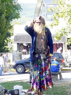
Most recently updated on January 1, 2024
Originally posted on April 19, 2021
We’ll travel through three states today, one of the few times we do that on this cross-country journey.
Along the way, we’ll visit the site where paintball was invented, stop in for some maple syrup, visit remembrances to a famous painter and a well-known poet, unveil the history of Uncle Sam, check out an apple orchard and settle in at a mountain town that made music history more than a half-century ago.
We begin by heading west out of Concord on Interstate 89. This freeway will take you all the way to the Canadian border. However, when it turns north a few miles outside of New Hampshire’s state capital we continue west on Highway 202.
After 20 minutes, we reach the town of Henniker, which proclaims itself as the “only Henniker on Earth.”
John Henniker, a London merchant who had shipping interests in Boston, might be glad to hear that. The town was named after him by the governor of New Hampshire in 1768, a few years after the first permanent settlers had arrived.
The area’s fertile soil led to early farming. Factories then sprang up, using water power from the Contoocook River.
In the 1800s, Henniker had a high rate of congenital deafness and the community developed its own sign language. Their system helped in the development of American Sign Language.
The Pats Peak Ski Area is located near Henniker. The resort opened in 1963. It now has 28 trails with 11 ski lifts. It also has the longest top-to-bottom beginner runs in New Hampshire as well as a high-capacity computerized snowmaking system.
Baseball Hall of Fame legend Ted Williams had a second home in Henniker because he was an avid fisher. His 300-acre estate was built in 1790. It’s listed as worth $1.5 million.

The first paintball game was played in Henniker, New Hampshire. Photo by Hire4event.
What brings us to this community of 2,700 people today, however, is an 80-acre wooded cross-country ski field just outside of town.
That is where the first paintball game was played more than 40 years ago.
Hayes Noel and his friend, Charlie Gaines, who was a professor at New England College in Henniker, decided to put a new twist on the children’s game “Capture the Flag.”
So, the two men and 10 other friends met at that ski field near Gaines’ home on June 27, 1981. They used guns loaded with pellets of gelatin and food coloring designed to mark trees for cutting.
The men wore camouflage clothing and shop googles. The contest, dubbed then as The Survival Game, was won by Ritchie White, who stealthily avoided his competitors and never fired a shot.
Sports Illustrated published a story on the contest and the men were besieged with requests from readers who wanted to play the game.
Gaines, Noel and Bob Gurnsey formed the National Survival Game company and developed the sport. They opened the first paintball field in 1982.
The business went well for a while, but eventually more than 100 lawsuits were filed against National Survival for injuries. Gurnsey declared bankruptcy in 1995.
Paintball has continued, even without its originators.
The number of participants peaked in 2007 at nearly 5.5 million in the United States. It had dropped to 2.5 million in 2021. Sales of paintball equipment hit a high point in 2007 at $300 million. It was at about $150 million in 2022
Some participants prefer the team competition with as many as 10 players on each side. Others gravitate toward the one-on-one contests. There are also numerous high-level skill leagues, including the NXL.
A historical marker was placed at the original game spot in 2011.
Syrup, Poetry, Painting and Social Security
We spend our final hour in New Hampshire driving in a southwesterly direction on two-lane Highway 9.
At the Connecticut River, we cross over into Vermont, our 30th state on this journey.
The Green Mountain State is diminutive and sparsely populated compared to other states.
It’s the 6th smallest state at 9,616 square miles, slightly larger than New Hampshire but smaller than Massachusetts.
It’s also the second least populated with 647,000 residents, ahead of only Wyoming. There are 24 cities in the United States with populations larger than Vermont, including Las Vegas.
Vermont’s most populous city is Burlington at 44,000 people. Only one other town here has more than 20,000. Burlington is the least populated of any of the 50 states’ most populated cities.

Montpelier has slightly less than 8,000 residents, making it the least populated of any state capital. Pierre, South Dakota, is the only capital that’s even close with about 14,000 residents.
Vermont’s populace is 92 percent white, one of the nation’s highest rates.
Vermont also has the third oldest median age at 43 years, behind only Maine and New Hampshire.
The Abanaki tribes were the first occupants of this region.
French explorers claimed the area as part of New France in 1609. The first European settlement was Fort St. Anne, built in 1666 to protect fur trading routes. The territory was ceded to the British after a 1763 battle during the French and Indian War.
As the Revolutionary War broke out, the region became the Vermont Republic. It was a sovereign entity until it became a state 14 years later in 1791. It was admitted as the 14th state as part of a compromise that allowed Kentucky to enter the Union as a slave state.
Vermont took an early anti-slavery stance.
Immigrants, in particular from Scotland and Italy, flooded into the state in the 1800s. Many of them worked on the railroad as well as in Vermont’s numerous granite quarries. Vermont granite is still used in public buildings and monuments, including some at Arlington National Cemetery in Virginia. The state still has active quarries for granite and marble. The Rock of Ages quarry near Barre in central Vermont is one of the world’s leading sources of granite.
Government is a big employer here. The agriculture industry is dominated by dairy products, although dairy farms have declined from 4,000 in 1975 to less than 600 now. Nonetheless, milk production has increased due to larger farms and better technology.
The biggest manufacturing sector is electronic equipment. There are also a number of “branded” Vermont-based products. One of them is Ben and Jerry’s Ice Cream, which was founded by Ben Cohen and Jerry Greenfield in 1978 at a refurbished gas station in Burlington.
Vermont is also the top maple producing state in the country, putting out more than twice what second place New York delivers. We’ll get a taste of that industry just up the road today.
In 2000, Vermont’s state legislature became the first to recognize same-sex civil unions. In 2009, the state approved same-sex marriage. In 2018, it became the first state to legalize marijuana through a legislative act as opposed to a ballot initiative.
—————————————–
As soon as we cross the border, we hit the town of Brattleboro, a community of 7,500 residents with some notable history in both children’s literature and our Social Security system.
The region was one of the places the Akenabi tribes lived. English settlers built Fort Dummer in 1724 as a trading post but also for protection. Brattleboro was chartered in 1753, becoming Vermont’s first town.
The community grew rapidly, especially after the railroad arrived in 1849.
The industries included printing, health resorts, saw mills, grist mills and textile mills.
The Estey Organ Company operated here from 1852 to 1961. At one point, its site included 30 buildings and it was the largest organ manufacturer in the world. The facility is now a museum.
Today, Brattleboro’s economy relies on education, healthcare and retail trade. A big part of that commerce in the downtown area that business leaders tout as three blocks of independent merchants along the Connecticut River.

Rudyard Kipling wrote “The Jungle Book” while living in a home with his new wife near Brattleboro, Vermont. Photo by Wikipedia.
Brattleboro does have two interesting historical side notes.
Author Rudyard Kipling lived in the neighboring town of Dummerston from 1892 to 1896 after marrying a Brattleboro woman. While he was here, he wrote his famous novel, “The Jungle Book.” He also penned “Captains Courageous” here. Kipling is quoted as saying he loved the stillness, suspense and seclusion of the winter weather and it inspired his writing. The house, known as Naulakha, is now a national historic landmark.
The other historic resident was Ida May Fuller.
Fuller lived the final eight years of her life with her niece’s family in Brattleboro.
She was born on a farm in Ludlow, Vermont, in 1874. She never married, had no children and lived alone for most of her life in that town.
Fuller worked as a legal secretary until she retired at age 65 in November 1939. That month, she signed up for a new federal retiree program known as Social Security.
Fuller was part of the first batch of 1,000 people who were processed by that agency. Somehow, she ended up in the top slot of that group and received check number 00-000-001 for $22.54 on January 31, 1940. That made her the first official recipient of a Social Security check.
The financial system that Social Security was built on during those early years was that people would live 10 years or less after they retired. Fuller, however, didn’t die until 1975 when she was 100 years old.
She collected $22,888 in her 35 years of retirement after only paying $24.75 into the system the final three years she had worked.
Today, 66 million people receive Social Security checks. The average monthly payment is almost $1,800 per month.
——————————————-
Before we leave the Brattleboro area, we need to take a sweet side trip into the neighboring town of West Brattleboro.
Along Ames Hill Road just west of that community is the Robb Family Farm.
It’s one of the more than 3,000 maple syrup operations in Vermont that produce more than 2 million gallons of syrup per year worth about $84 million.
The state’s syrup industry is enjoying a rebound in recent years as consumer turn away from refined sugars and gravitate toward more natural products.

The Robb Family Farm specializes in maple syrup. Photo by the Vermont Chamber of Commerce.
However, climate change is raising some concerns. Growers are worried about issues such as a shorter tapping season and tree health.
Most Vermont syrup operations are local and family owned.
Such is the case in West Brattleboro.
The 360-acre Robb Family Farm was established in 1907 by the grandparents of the current managers. It had a thriving dairy business, but that part of the operation ended in 2011 mainly due to unstable prices in the milk market.
Natural beef products from the cows who graze the open fields here are still sold, but the main commodity is maple syrup.
The Sugar House on the property sells three grades of syrup as well as maple candies.
The syrup comes from the surrounding land. The family now has 3,200 taps on the nearby trees. They hope to increase that to 6,000 taps in the near future. The farm produces about 800 gallons of syrup a year. The busy time of the season is mid-February to mid-April.
———————————–
We have one more stop in Vermont before we leave the state.
From the Robb Family Farm, we take Ames Hill Road to Town Hill Road back to Highway 9.
As we travel west on that roadway, we pass through the Wilmington area.
We’ve climbed to 1,500 feet elevation in the Green Mountains.
This region is known as southern Vermont’s snowbelt. Some of the areas here get as much as 180 inches of snow a year. During a four-day period in February 2010, Wilmington itself received 54 inches of snow.
After 45 minutes on Highway 9, we reach the town of Bennington, a community of 8,700 people just east of the border with upstate New York.
Bennington has quite a history ranging from Revolutionary War heroes to one of the country’s most famous poets to one of the country’s best known female painters.
The town received its charter in 1749 by Governor Bennington Wentworth, who named the settlement after himself. It was the first community in Vermont to have a charter.
The community was founded in 1761 by a group of 20 pioneers. The village had easy access to natural resources and water power. In the 1760s, a grist mill and lumber mill were built along the Walloomsac River.
During the American revolution, Ethan Allen, a soldier and frontiersman, organized the Green Mountain Boys militia in Bennington in 1770. Their initial mission was to protect the property rights of local residents who had received land grants from New Hampshire authorities as opposed to those who had received them from New York officials.
Their biggest victory was when they captured Fort Ticonderoga in northern New York from the British in 1775.
In 1777, the Battle of Bennington erupted with 1,100 New Hampshire soldiers defeating 800 German mercenaries, local loyalists, Canadians and native tribe members who were fighting for the British. The pro-British contingent had been sent to the Bennington area to capture supplies stored there.
The battle actually took place in Walloomsac, New York, 10 miles northwest of town, but Bennington was the target.
The Bennington Battle Monument in town commemorates the action. It was completed and dedicated in 1891. The 306-foot-high tower is the tallest human-made structure in Vermont.
In the 1800s, Bennington became a manufacturing center, in particular with wood processing. The region was also known for its pottery, iron and textiles.
Today, healthcare is a primary industry with Southwestern Vermont Medical Center being the city’s largest employer. Manufacturing and retail trade are also major contributors.
The historic downtown is filled with small, independent businesses. In 2005, local leaders approved a Big Box law that limited large retail outlets to 75,000 square feet. A Walmart store was approved after this ordinance was enacted.

The Bennington Museum in Vermont has the world’s largest collection of Grandma Moses paintings. Photo by Vermont Attractions Association.
Bennington also is home to some memorials dedicated to a literary giant and a famous painter who embodies the phrase “Better late than never.”
Poet Robert Frost lived in the Bennington region in the 1920s.
Frost, known for poems such as “The Road Not Taken,” was the named Vermont’s poet laureate in 1961. He recited a poem at the inauguration of President John Kennedy that year.
Frost, who died in 1963, is buried in a cemetery in Bennington.
The Robert Frost Stone House Museum in nearby Shaftsbury honors the place where Frost lived as well as farmed, grew apples and wrote most of his poetry.
The other artist remembered in Bennington is Anna Mary Robertson, better known as Grandma Moses, who began painting in 1938 when she was 78 years old.
Moses lived much of her life in Eagle Bridge, New York, just on the other side of the border. She was also good friends with artist Norman Rockwell, who lived nearby in Arlington, Vermont. He included her image in his painting “Christmas Homecoming.”
Moses is buried in Hoosick, New York, where she died in 1961 at the age of 101.
The Bennington Museum, though, has a gallery dedicated to Moses. It’s the largest collection of her paintings and other personal items in the world.
The museum, which dates back to 1852, contains 30,000 artifacts, 15,000 photographs and 1,600 rare books.
Uncle Sam, Apples and Rock Music
It only takes a few minutes on westbound Highway 9 for us to enter the state of New York for the second time on this journey.
The Empire State’s population of 19 million is the fourth largest among the states. However, more than 40 percent of the state’s residents live in New York City. Only five other cities have populations above 100,000. They are Buffalo, Rochester, Yonkers, Syracuse and Albany. Most of the state, in other words, is filled with small to medium-sized towns.
New York is the largest of the northeastern states, but its 54,555 square miles is only 27th among states overall. Even Iowa is bigger. So are Georgia and Florida.
Its geography is diverse. Its eastern half is rolling plains while the western sector is more mountainous. Its eastern region sits along the East Coast while its western section is considered part of the Great Lakes region. The central part of the state is dominated by the 11 “finger lakes.” We’re going to see a lot of this topography over the next three days.

The first native tribes occupied the territory more than 10,000 years ago. They were nomadic hunters of large animals such as mammoths and great bison.
Explorers from England, France, Sweden and Holland were among the first Europeans to visit in the 1500s. Henry Hudson explored the region in 1609. The Dutch built Fort Nassau at what is now the state capital of Albany in 1614. The Dutch settled other areas, including the Hudson Valley.
England seized the territory in 1664. New York was a center of the Revolutionary War. Nearly one-third of those battles were fought here.
The Erie Canal had a major impact on the state’s economy. When it was completed in 1825, it connected the Great Lakes with the Hudson River. That allowed commerce to flow from Lake Erie all the way to New York City harbors. Farm products from the Midwest were shipped via the canal to the East Coast. Cotton from the South could wind its way up the Mississippi to the Great Lakes and then New York. In turn, exports from New York could be more easily transported to the middle of the country.
In the 1800s, New York led the nation in manufacturing and wholesaling. That base continued strong until the 1950s when financial services took over.
New York also has a surprisingly busy agricultural sector with more than 36,000 farms. Most of that industry is located in the western portion of the state.
In colonial days, the state was a leading producer of wheat. Today, New York is tied for second in apple production with Michigan, behind only Washington. It’s also the fifth leading producer of milk.
A lot to see, so let’s barrel forward.
———————————–
About 40 minutes after crossing the state line, you reach the city of Troy, a community of slightly less than 50,000 that lies along the eastern banks of the Hudson River.
It’s a town with a rich history that includes one of our country’s symbols and one of our nation’s favorite Christmas stories.
The Mohicans lived in this region for centuries. In recognition of this fact, the tribe in 2015 opened its historic preservation office in Troy.
The area was the northernmost point of Henry Hudson’s 1609 exploration.
The first settlers were Dutch, who purchased land from local tribes between 1630 and 1657. The region was conquered by the British. The town was laid out in 1786 and was named a few years later after the ancient city of Troy.
In the 1800s, Troy found itself at the confluence of two major waterways – the Hudson River and the Erie Canal. It also was a railroad center.
The city quickly developed into a major shipping point for meat, vegetables and other products down the Hudson River. It was also a cog in the Industrial Revolution machine, producing iron and steel that was also transported down the Hudson.
In addition, Troy was a leading manufacturer of shirts, collars and cuffs. The town was nicknamed “Collar City.” The industry produced the Collar Laundry Union, the nation’s first female labor union, in 1864.
At the turn of the 20th century, Troy was the fourth wealthiest community per capita in the country. That prosperity faded when the steel industry moved to Pennsylvania and the garment industry moved to the southern states.
The local economy turned more toward the stable industries of government, education and healthcare employment.
There’s also a tech sector. One of the big players is the Rensselaer Polytechnical Institute. It was founded in 1824 and is the oldest technical research university in the United States. The private institute is now part of New York’s Tech Valley. Nearly 6,000 undergraduate students here study renewable energy, cybersecurity, biotechnology and materials science.
In the past decade, the struggling downtown was revived by the influx of hip restaurants and specialized retailers that included a pottery studio and a handcrafted soap shop. On Saturdays, as many as 15,000 people have attended the waterfront farmers market.

The Uncle Sam statue in Troy, New York. Photo by the Rensselaer County Regional Chamber of Commerce.
Troy has a trio of interesting historical footnotes.
The first involves the origins of the national symbol Uncle Sam. The figure is reportedly based on Samuel Wilson, a meat packer who supplied soldiers with barrels of beef during the War of 1812. Those packages were stamped with “U.S. Beef” for United States. However, some of the soldiers referred to the initials as “Uncle Sam’s Beef.” A newspaper picked up the story in 1813 and the nickname “Uncle Sam” for the federal government was born.
The familiar Uncle Sam image with the white beard and the suit with the stars and stripes was popularized in the 1860s and 1870s by Thomas Nast. The editorial cartoonist was also the creator of the modern image of the jolly, hefty Santa Claus as well as the donkey for the Democratic Party and the elephant for the Republican Party.
The iconic image of Uncle Sam pointing his finger straight forward and saying “I Want You” was created by artist James Montgomery Flagg. It first appeared on the cover of Leslie’s Weekly magazine in July 1916. He was initially used as a recruitment poster for the U.S. Army during World War One.
Wilson died in 1854 at the age of 88. He is buried in Oakwood Cemetery in Troy.
In 1961, Congress officially recognized Wilson as the progenitor of Uncle Sam. In 1989, Congress recognized Wilson’s birthday of September 13 as Uncle Sam Day.
Troy calls itself “The Home of Uncle Sam” and hosts a parade in September in honor of Wilson. There’s also an aluminum Uncle Sam statue on River Street.
Author Kurt Vonnegut also lived in the Troy area. Vonnegut, the author of “Slaughterhouse Five” and other novels, based many of his stories involving the town of Ilium on Troy.
On December 23, 1823, the Troy Sentinel became the first publisher of the famous “A Visit from St. Nicholas” poem. The story that begins “Twas the night before Christmas” was originally published anonymously, but in 1837 Clement Clark Moore was officially credited as the author. The Sentinel was a weekly paper that operated only from 1823 to 1832.
The city’s newspaper today is the Troy Record, which in keeping with our digital age, closed its only office in February 2019. All their employees work remotely now. The paper still has a printed edition as well as its online presence.
————————————
We leave Troy, headed south of Interstate 787, a freeway only 10 miles in length.
The freeway hugs the western shoreline of the Hudson River.
Most people think of the Hudson as the river that flows past the western side of Manhattan and joins the East River to form New York’s harbor where the Statue of Liberty stands.
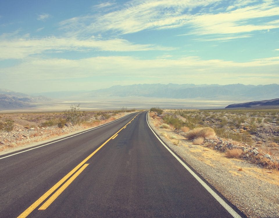
However, the Hudson is a 315-mile river that begins at Lake Tear of the Clouds at 4,332 feet elevation in the Adirondack Mountains of upstate New York.
It meanders past Troy, the state capital of Albany and West Point before reaching New York City. It was also the all-important eastern outlet for the Erie Canal.
The average depth of the river is 30 feet, although it plunges as deep as 202 feet. It drains an area of 13,370 square miles.
The river, named after explorer Henry Hudson, is narrower in its northern half before it widens south of Albany as part of the Hudson Valley.
Like many of our nation’s rivers, the Hudson is suffering from pollution. Industrial waste and raw sewage have been dumped into it for years.

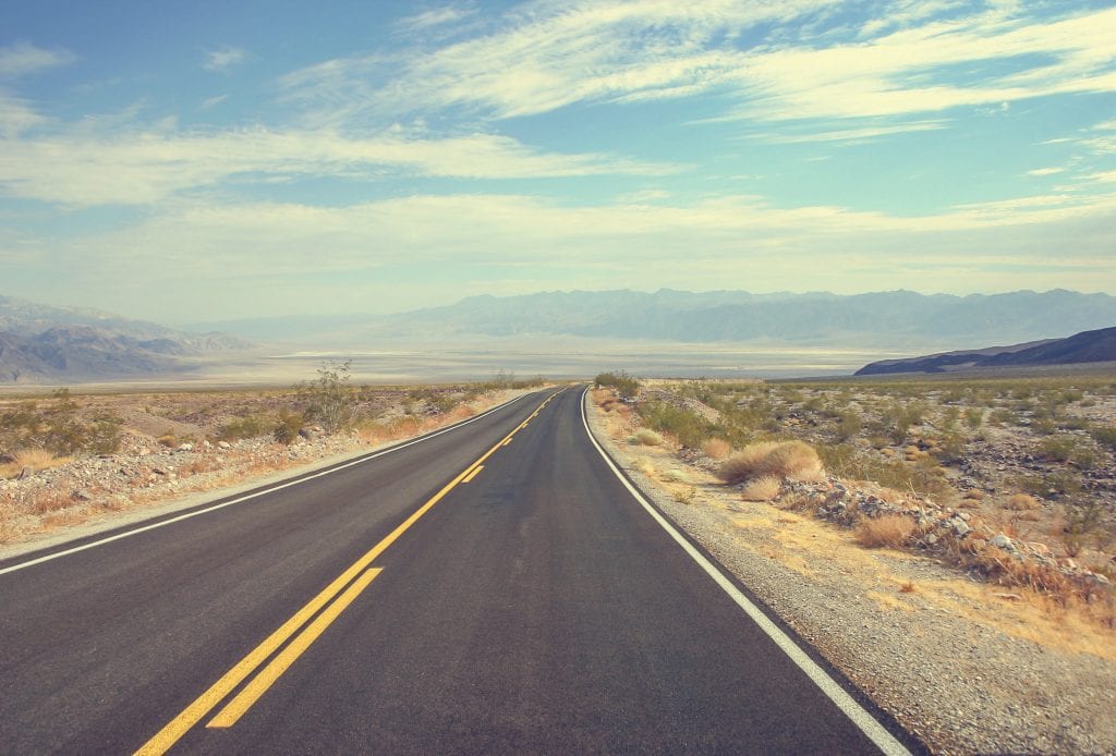
The Hudson River in upstate New York. Photo by Adventure Sports Rafting Company.
Between 1947 and 1977, the major source of pollution was from a General Electric plant in Washington County that discharged pollutants such as PCBs into the waters.
State officials note that the Hudson waters near a General Motors in Tarrytown, New York, used to resemble the color of paints applied to cars there.
In 1970, fish were dying in droves due to the lack of dissolved oxygen that aquatic life needs to breathe. In addition, 150 million gallons of sewage water entered the Hudson near Manhattan every year until 1986.
State officials say water quality has improved since the 1960s.
Since 1965, they note, the Hudson has benefitted from a $1 billion bond act approved by state voters that year to improve sewage treatment. The 1972 Clean Water Act has also helped clear the river.
There are still toxic leftovers from past decades, in particular PCBs, that linger. State officials say the Hudson is safe to swim in and even take a small drink. However, they still advise against eating fish caught from the river due to these contaminants.
They also note that there are new pollutants entering the river, in particular antibiotics and hormones used in drugs.
However, state officials say the biggest problem facing the Hudson today is rain runoff that carries automotive fluids from parking lots as well as fertilizers and pesticides from lawns into storm drains and out into the river.
In 2019, the discovery of large sturgeon returning to the river was seen as a sign that the Hudson River’s waters are starting to recover.
However, officials say there is still a long way to go.
In 2020 the Hudson was named the second most endangered river in the United States by the organization American Rivers.
State officials say more cleanups are needed as well as alterations in manufacturing processes, redesigning products and reducing industrial discharges.
They also call for improvements at sewage treatment facilities, some of which have been operating since the 1970s and are near the end of their design life.
They estimate a $1.6 billion investment is needed over the next 20 years to maintain water quality.
———————————–
Just 8 miles downstream from Troy is Albany, the 20th state capital we’ve entered.
This city of 100,000 people has a diverse ethnic mix with 50 percent of residents listed as white, 27 percent Black, 10 percent Hispanic or Latino and 7 percent Asian.
The Mohican and Munsee tribes originally lived in the area, making use of the forests and rivers in the Hudson Valley.
The site was claimed for The Netherlands by Henry Hudson when he explored the region in 1609. The Dutch settled here first, building Fort Nassau in 1614 for fur trading and Fort Orange in 1624.
The British took control in 1664 and the city was chartered in 1686, making it the longest continuously chartered city in the country. It was named as state capital in 1797. Only Santa Fe, New Mexico, has been a state capital longer.
Albany was a center for trade transportation in the 1700s and 1800s.
It was at the north end of the navigable Hudson River, which prompted Robert Fulton to start a steamboat service from Albany to New York City in 1807.
Albany was also the original eastern terminus for the Erie Canal when it opened in 1825. In addition, it was the site for one of the earliest railroad systems when trains began rumbling through in 1831, making it one of the primary transportation corridors to the Great Lakes region.
The Albany area also was home to wheat, sheep and dairy farms as well as iron foundries, beer breweries and publishing houses.
The population declined in the late 1900s due to urban sprawl and suburbs. During the 1990s, the state awarded the city $234 million for building and renovation.
The city’s economy now focuses on government and healthcare. Like Troy, it is also part of Tech Valley, in particular with the nanotechnology industry. That sphere includes the NanoTech complex at the State University of New York Polytechnic Institute campus in Albany. More than 150 companies have operations here to research and develop nanoscience.
——————————————
Out of Albany, we merge onto southbound Interstate 87, a freeway that takes you from the outskirts of New York City to the town of Champlain at the Canadian border.
We roll along the edge of the Hudson River for another half-hour before reaching the community of Climax, where we find the Boehm Farm.
The family-owned apple farm is one of many such operations in this part of the Hudson Valley.

The Boehm Apple Farm near Climax, New York, is one of 600 apple farms in the state.
It’s been in operation since 1903. It’s owned by Henry and Mary Boehm and is the only family owned and operated apple orchard left in Greene County.
Apples have been grown in New York for 300 years, the first orchard being planted near Flushing. The crop was brought to the United States by European settlers.
The New York apple industry produces nearly 30 million bushels per year.
There are 600 commercial apple growers statewide on 55,000 acres of orchards in six major districts throughout the state. Those regions include the Eastern Hudson Valley and the Western Hudson Valley, where the Boehm farm is located.
The Boehms grow a variety of fruit on their acreage. The crops include peaches, pumpkins, cherries and plums.
However, their signature product is apples. The varieties here include cameo, Cortland and empire apples. Besides selling their fruit whole, the Boehms also offer jams, jellies, pies, syrup and doughnuts.
—————————————————-
Long before the famous 1969 rock festival that was actually held 60 miles away, Woodstock was a colony sought out by musicians and artists.
This community of 3,000 people with a median age of 59 in the mountains of central New York is only 45 minutes south of Climax. It’s also a bit inland from the Hudson River, so you need take Highway 212 off Interstate 87 to get here.
Today, the town remains a free-spirited, counter-culture community. Tinker Street, Mill Hill Road and other lanes along the downtown are filled with crafts, tie-dye clothing, crystals, homemade candles, trinkets and books.
Just outside of town is a Tibetan Buddhist monastery. There’s even a “music chapel” that was established in 1916 in the nearby woods. It’s the site of an annual chamber music performance, among other events.
However, Woodstock had a bit of an industrial history before it developed into an artists’ enclave.

Woodstock, New York, is a small mountain community in the central part of the state. Photo from WordPress.com.
Native American tribes lived here along Sawkill Creek. The first European settlers arrived in the mid-1700s. The town was established in 1787 in what was then the frontier of New York.
Early pioneers tried farming in the rocky soil. In the early 1800s, saw mills and grist mills sprung up as did a nearby glass factory. In the 1830s, tanning industries began using the abundant local water supply as well as the tanic acid from the nearby hemlock trees. Bluestone quarries were also established and hotels were built in the late 1800s as mountain retreats for city dwellers.
In the late 1800s, painters from the Hudson River School arrived. The Arts and Crafts Movement began in 1902. In 1903, the Birdcliffe Art Colony emerged, supporting the crafts of painting, metal works, weaving, ceramics and furniture. In 1906, the Art Students League of New York was formed, mostly for landscape painting.
The Woodstock Artists Association was formed in 1920, followed by the Woodstock Guild of Craftsmen in 1939. The Woodstock School of Art came along in 1968.
In the 1960s, the music scene began to evolve.
Bob Dylan, the famous rock and folk singer, lived in Woodstock from 1965 to 1972 and wrote many of his classic songs here. He was visited by other famous rock ‘n’ roll musicians, including Janis Joplin and Jimi Hendrix. Dylan had a famous and mysterious motorcycle accident in town in 1966 that limited his touring abilities at that time.
A number of other celebrities have either lived here or have summer homes in town.
In 1967 and 1968, the Woodstock Sound-Outs outdoor concerts were held on nearby farmland. They set the wheels in motion for the famous 1969 concert that was supposed to be held here but ended up going elsewhere when local officials wouldn’t grant the promoters a permit.
We’ll have more on that story when we visit the actual site of the Woodstock concert tomorrow as Day 32 of our journey unfolds.
For now, we’ll put up our feet in this mountain community and call it a day.