
Day 54: Motoring Through Montana on the Way to Yellowstone
May 12, 2021
Day 52: The ‘Rocky’ Road Through Colorado and Wyoming
May 10, 2021
Most recently updated on February 23, 2024
Originally posted on May 11, 2021
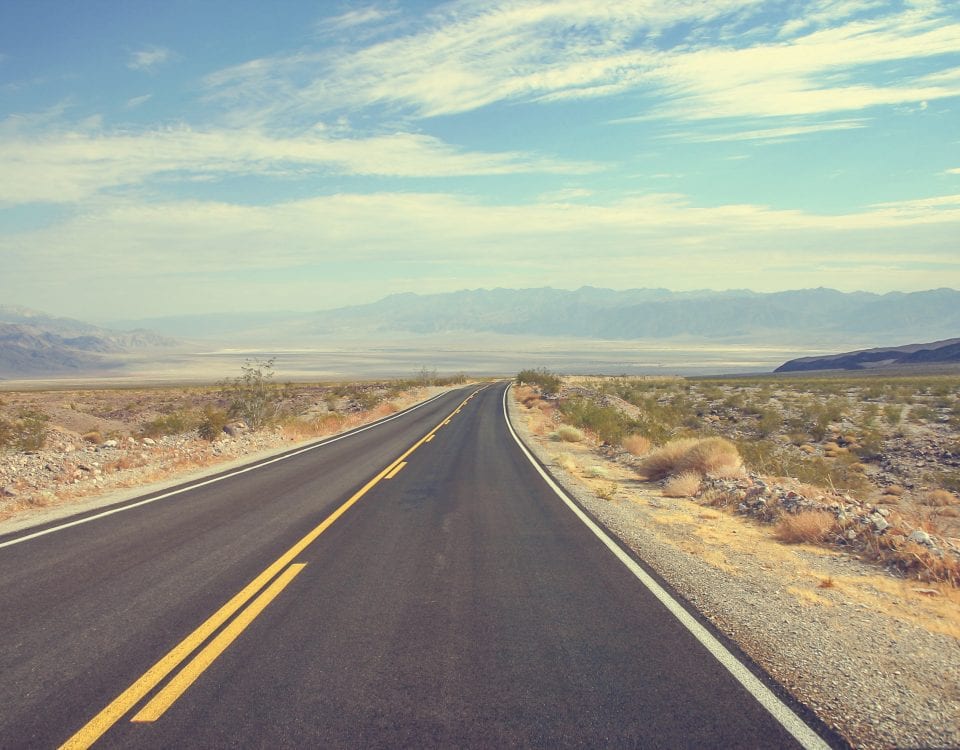
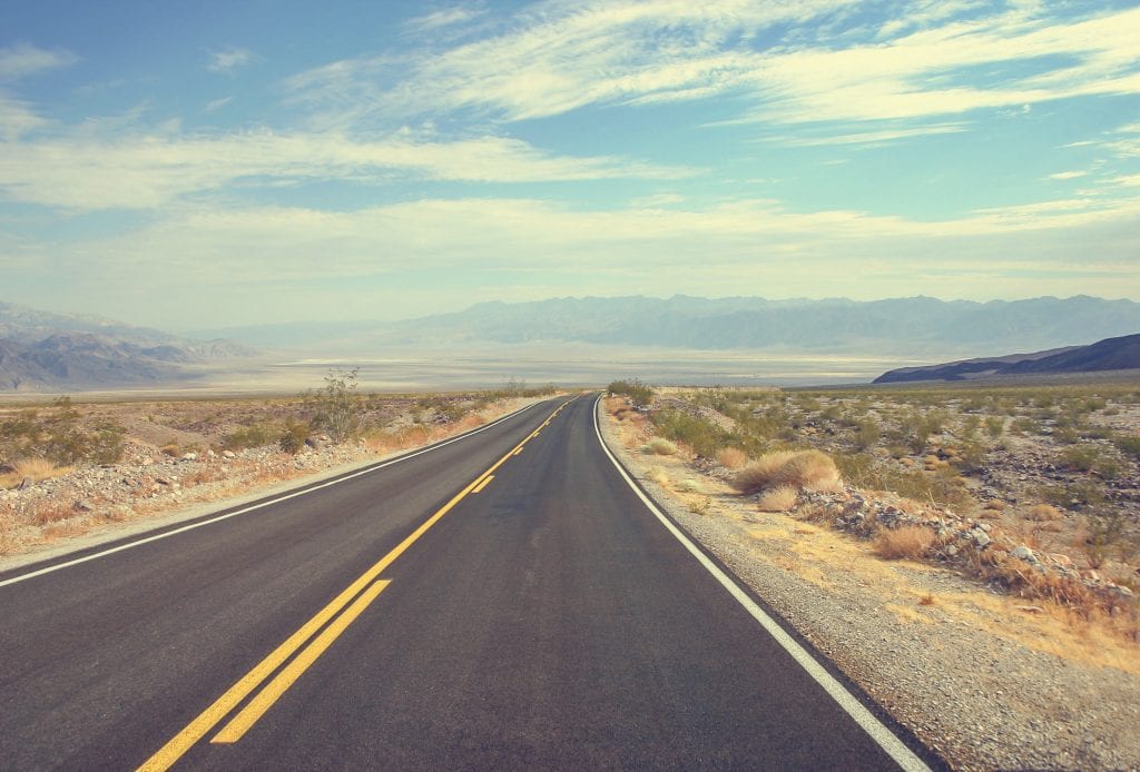
We’re taking a straight shot north through Wyoming today before entering the wide open spaces of Montana.
On Day 53, we’ll be on the hunt for jackalopes, drive by an oil field that was embroiled in a presidential scandal and check out a rural ranch where Queen Elizabeth II once stayed. Then, it’s on to a battlefield famous in U.S. history as well as the biggest and busiest town in Montana.
We start today’s journey by rolling onto Interstate 25, our friend from our New Mexico travels. After an hour, we cruise into Wheatland, a community of 3,500 whose existence is owed to the miracle of irrigation.
The Shoshone, Cheyenne, Comanche and Lakota Sioux were among the tribes that lived in the region. Before the 1800s, the land here was arid with desert-like vegetation.

That changed in 1883 when seven men, led by rancher and future senator and governor Joseph M. Carey, established the Wyoming Development Company in an effort to irrigate the Wheatland Flats. By fall 1883, an irrigation system was constructed that included a 2,380-foot tunnel to divert water into Bluegrass Creek and two of the system’s canals. By 1915, farms in the region formed the nation’s first private irrigation district.
The Wheatland Irrigation District is still the largest privately owned irrigation system in the country and the local economy is still reliant on water. The Wheatland Development Company building on Main Street is still there and is home to the Wild Whisk grocery shop.
In 1887, the Cheyenne and Northern Railway reached Wheatland. Town lots were sold in 1894 and the city was incorporated in 1905.
The Laramie River Station coal plant just outside Wheatland has been producing electricity since 1980. The facility is operated by Basin Electric Power Cooperative with electricity being sent to substations in Wyoming, Nebraska and Colorado. In September 2021, however, it was announced that Laramie River Station would be among the coal plants being closed by 2039. Some Wyoming officials are looking into nuclear power plants as a replacement for coal plants.
In August 2020, the federal Bureau of Land Management unveiled a proposal to create corrals on public land in Wheatland as well as in Canon City, Colorado and Sutherland, Utah, to house wild horses. The three complexes hold 8,500 wild horses and burros on a short-term basis until they can be adopted, sold or placed elsewhere. The Wheatland facility houses between 500 and 3,500 horses and burros with monthly adoption days. The program is designed to prevent surplus population among the wild horses on open range land. In spring 2022, the corral was closed to the public after an outbreak of an illness known as “strangles” among the horses. The auctions resumed in March 2023.
Jackalopes, Teapots and Queens
We’re on the lookout for a mythical animal as we head north out of Wheatland on I-25.
An hour up the freeway we pull into Douglas, a community of 6,500 with a strong horse culture and a piece of urban legend.
Trappers as well as travelers heading westward came through this region on the Oregon Trail beginning in the 1820s. The first settlement in Douglas area was in 1867 when Fort Fetterman was built. The town was eventually named after Senator Stephen Douglas, the Democratic nominee for president in 1860.

One of the jackalope statues in Douglas, Wyoming. Photo by Atlas Obscura.
The town was founded in 1886 when the Fremont, Elkhorn and Missouri Valley Railroad arrived. By 1887, Douglas was a shipping center for region’s cattle and sheep ranches as well as a supply center for railway workers, cowboys and soldiers stationed at Fort Fetterman.
The town was the site of a World War Two internment camp named Camp Douglas that housed Italian and German prisoners of war from 1943 to 1946. The encampment was on 687 acres and contained 180 buildings.
Uranium and coal mining operations were established just north of town. The oil and natural gas industries have also fueled the regional economy. A 762-megawatt coal-fired power plant is in nearby Glenrock. The plant’s owner, Rocky Mountain Power, announced in March 2023 it plans to close 9 of its 11 coal-burning until in Wyoming by 2030 as it moves more toward wind and solar power. The Glenrock plant will remain operational until 2042.
The economy today in Douglas is a mix of agriculture, energy and tourism. Like other areas of the state, the region is also looking at wind power. In December 2020, a 192-turbine wind farm in Converse County became fully operational. The plant is capable of generating 533 megawatts of electricity. More wind turbines are being planned for that area, too.
Douglas is known as the center of the state’s horse culture. The Wyoming State Fair is held here every August.
The town is the also the origin of the jackalope mystique. In 1934, Douglas resident Douglas Herrick created the legend while hunting for jackrabbits with his brother Ralph. The brothers had tossed a rabbit carcass next to deer antlers at Doug’s taxidermy shop when they came up with the idea. The train museum in Douglas issues jackalope hunting licenses good only between sunrise and sunset on June 31. There is an 8-foot jackalope statue in downtown Douglas as well as 3 or 4 others around town.
———————————
As you depart from Douglas, Interstate 25 bends to the west.
After 45 minutes on that stretch of freeway, you come upon Casper, the second most populous town in Wyoming with 58,000 residents.
The city lies along the North Platte River at the foot of Casper Mountain in the Laramie Mountain Range. It’s nicknamed “The Oil City” for its history of oil industry and cowboy culture. It labels itself as the “Year Round Mountain Town.”
The region was home to tribes such as the Shoshone, Crow, Cheyenne and the Arapaho. In the 1840s, the settlement became the site of ferries that took people across the North Platte River. In 1852, a bridge was built across the river. Casper developed into an Overland Stage stop in 1859 and a Pony Express stop in 1860. A telegraph station was established in 1861.

The National Historic Trails Interpretive Center in Casper, Wyoming. Photo by Exit78.
Fort Casper was built in 1860s in response to a mass migration of land seekers along the California, Oregon and Mormon trails. The fort was designed to protect telegraph and mail service. Numerous battles were fought with Native American tribes. Lt. Caspar Collins was killed in battle in 1865. The fort and other entities are named after him, although they are spelled “Casper” due to a misspelling when the Army renamed the town. In 1867, the military abandoned the post after the Transcontinental Railroad took away the importance of the trails.
Casper was officially founded in 1888 when the Fremont, Elkhorn and Missouri Valley Railroad arrived. The town developed into a shipping point for cattle and wool.
The settlement grew even more when oil was discovered in the 1890s. Casper became a regional petroleum industry center. Oil was first discovered in 1889 in the Salt Creek Oil Field, which has produced more oil than any other field in the Rocky Mountain region. The first refinery was built here in 1895 and the town has had these fuel-producing facilities ever since. More recently, coal and uranium deposits have been mined.
During World War Two, the Casper Army Air Field with 400 buildings was built west of town.
The Casper Wind Farm opened in 2009 and operates nearby with 11 turbines that produce 16 megawatts of electricity. Like we saw in Iowa on Day 44, there is a need in Wyoming to dispose of old parts when wind turbines are upgraded or replaced. The Casper Regional Landfill is being used as a partial solution. As of September 2020, more than 1,100 old turbine blades had been deposited at the landfill. There are now discussions about possibly recycling the blades. A plan approved by state officials in 2020 to dump the blades into coal mines that are being reclaimed hasn’t received necessary federal approvals. A local artist has proposed using some of the blades to build a sculpture that would be a replica of the Stonehenge monument in England.
Casper is the home of the National Historic Trails Interpretive Center. The complex has exhibits on 1800s pioneers as well as the region’s historic trails. The 11,000 square foot facility opened in 2002.
Before we leave, we should note that former Vice President Dick Cheney grew up here in Casper.
—————————————–
Interstate 25 juts back to the north as we head out of Casper.
There is a lot of open space as well as rock formations in this part of Wyoming. One of them has its name tied to a famous presidential scandal.
The sandstone formation is near the oil fields in the Teapot Dome area north of Casper. The rock outcropping is now 75 feet tall and about 300 feet in circumference. At one time it was said to look like a teapot with a handle and spout, but windy weather has eroded a lot of it away.

The Teapot Dome rock formation north of Casper, Wyoming. Photo by Wikipedia.
This was the area where in 1922 Interior Secretary Albert Fall in the administration of President Warren Harding transferred oil production rights from the federal government to Harry Sinclair of Mammoth Oil, a subsidiary of Sinclair Oil in exchange for bribes. Fall was convicted and sent to federal prison and the Teapot Dome scandal dogged the brief Harding presidency.
The area was listed on the National Register of Historic Places in 1974. The famous formation is located off Highway 259 after it branches out from Interstate 25 about 20 miles north of Casper. However, online reviewers say don’t try to drive to it. It is blocked off by private property and isn’t much to look at anyway.
So, we zoom ahead on I-25. Almost an hour after leaving Casper, we pull into Kaycee, one of the smaller towns in Wyoming with less than 300 residents. Despite its size, Kaycee has its name attached to some pretty big western lore.
The first European settlers were group of trappers that built a trading post east of town. John Nolan was the first homesteader after he established a ranch along the Powder River. The property was attacked during Cattlemen’s Invasion of 1892. The ranch was burned and two men leasing the ranch were killed. This attack was a prelude to the Johnson County War, which was a program designed by outlaws to intimidate smaller ranchers and get them to leave Wyoming.
The Bozeman Trail cut through here. The 500-mile route followed Native American trails and explorer routes. It connected the Oregon Trail with the Montana gold rush areas. It was first traveled in 1863 and was subject to attacks from local tribes.
The town was incorporated in 1906 and named “KC” after Nolan’s ranch brand. However, the government required the town’s name be spelled out, so it became “Kaycee.”
Today, the town’s economy is focused on livestock and farming along with oil and gas exploration outside of town. There are some sights for tourists to check out.
One of them is the Hoofprints of the Past Museum, which was founded in 1989 by Kaycee volunteers to preserve the history of cattle ranching in the region. Other heritages highlighted here include Native Americans, the Bozeman Trail, trappers, traders and pioneers. There are also artifacts from Fort Reno and the Dull Knife Battle. Some wagons and a 100-year-old chuck wagon are on display, too.
The region is also home to the so-called Hole in the Wall, a meeting place in the foothills of the Big Horn Mountains of Johnson County. The location was reportedly used from about 1860 to 1910, particularly by the Hole in the Wall gang, a group of outlaws and cattle rustlers that included Kid Curry, Black Jack Ketchum, the Sundance Kid and Butch Cassidy’s Wild Bunch gang. The gang met at an 1883 log cabin that has been preserved at the Old Trail Town site in Cody, Wyoming.
—————————————–
We keep chugging north on Interstate 25 for another 45 minutes until that freeway ends when it merges with Interstate 90, our familiar pal for our South Dakota travels on Day 50.
We continue northbound on I-90 for another half-hour before we reach Sheridan, a community of 19,000 and the sixth most populous town in Wyoming.
Numerous tribes battled the U.S. Calvary here in the 1860s and 1870s. The first European settler was a fur trapper who built a cabin in 1878. The town was founded in 1882 and the railroad arrived in 1892. The railroad industries flourished as did dude ranches. Coal mines opened in 1892 and the agriculture and cattle industries developed afterward.
We’ve stopped in this town in northern Wyoming for two reasons.
The first is the town was the place where Buffalo Bill Cody auditioned performers from the porch of the Sheridan Inn for his Wild West shows. Cody had purchased an interest in the hotel and thought he’d make use of it. Several local cowboys were hired for the show and traveled to Europe with Cody.
The second reason is a royal visit that occurred here in 1984. Queen Elizabeth II of England stayed at a local ranch as a guest of Wyoming Senator Malcom Wallop, whose paternal grandfather was part of British royalty. The visit was kept secret until people saw the queen shopping at local stores. Her royal majesty spoke to President Ronald Reagan by phone during her four-day visit here.
Making Our Way To Montana
It’s only a few more minutes northbound on I-90 before we enter Montana. The border we cross is actually the 45th parallel, that imaginary line halfway between the equator and the North Pole. It’s our third trip across the 45th on our voyage.
The Treasure State is the fourth largest in the country at 145,556 square miles. However, its 1 million-plus residents place it 43rd in population, just ahead of Rhode Island.

The western half of Montana has numerous mountain ranges. The eastern half is prairie terrain and badlands. The state is in the heart of Big Sky Country.
The eastern portion of Montana was part of the Louisiana purchase in 1803. British and French fur traders had been operating there, sometimes in conflict with local tribes. The first Euro-American settlement was in 1841. Fort Benton established in 1847 as a fur trading post on the Missouri River.
Cattle ranching began in 1850 and continues to this day. Gold was discovered in 1852 and mining of the metal continued until the 1870s.
In 1870, there were an estimated 13 million bison in Montana. Commercial hunting was instituted, some of it with the goal to wipe out a source of food for Native American tribes. By 1902, only about 50 bison were left in Montana, although the herds have been rejuvenated. There are now an estimated 5,000 bison in the state.
One animal that is not lacking in population in Montana is wolves. In 2021, the state adopted laws to make sanctioned killing of the four-legged predators easier. The wolf population has dipped in recent years, but there are still more than 1,000 of them in Montana.
The economy is primarily agriculture, in particular beef cattle ranching and cereal grain farming. There’s also oil, gas and coal as well as mining and lumber. The state has numerous ecotaxes and severance taxes for natural resource extraction.
Tourism is a vibrant part of the economy with 12 million tourists a year visiting Yellowstone Park, Glacier National Park and other spots.
Microbrewing has also taken hold. Montana is second in nation in craft breweries per capita.
Montana has a place in political history. The state had the country’s first female congressional representative.
Jeanette Rankin was born in 1880 in Missoula County. She was elected as the representative for Montana’s first congressional in 1916, four years before women could vote. She served one term at that juncture and is still the only woman to serve Montana in Congress. Rankin was elected again in 1940 and served another single term.
Rankin was a pacifist, voting against the declaration of war in World War One and was the only member of Congress to vote against the declaration of World War Two after Pearl Harbor was bombed. She was also progressive on gender and civil rights and was instrumental in getting the 19th Amendment passed during her initial term, paving the way for women to vote.
Rankin was a Republican. She died at the age of 92 in Carmel, California, in 1973. At the time, she was reportedly thinking about running for Congress again in opposition to the Vietnam War.
Rankin Ranch was the longtime summer residence of Rankin and her family. It’s now a national historic landmark. The 14,000-acre ranch is north of Townsend, off Highway 284 in Broadwater County near the Helena National Forest. Most of the ranch is open prairie. The house is a single-story clapboard home that was built in 1923 after Rankin’s brother purchased the original 2,000-acre plot.
———————————–
You’re only 40 miles past the Montana border when you come upon the scene of one our nation’s most famous, most bloody and most one-sided battles.
The Little Bighorn Battlefield National Monument is just north of the town of Garryowen where Interstate 90 meets Highway 212.
It was here in June 1876 that Lt. Col. George Armstrong Custer and 262 other U.S. Calvary soldiers were killed by a combined force of several thousand Lakota Sioux, Arapaho and Northern Cheyenne tribes. The ill-advised battle was also a disaster for the Custer family. Two of Custer’s brothers as well as a nephew and brother-in-law also died at Little Bighorn.
The battle was part of the Great Sioux War of 1876 and one of the last attempts by the Plains tribes to keep their land. It was a major victory for Native American forces, but it was also their last. The reaction to the massacre of U.S. troops initiated an aggressive five-year campaign that ended the native tribes’ occupation of territory in the Great Plains.
The logistics of the Battle of the Little Bighorn are a bit complicated, so we’ll stick to the basics.

The Little Bighorn Battlefield National Monument in southern Montana. Photo by Locationscout.
The encounter, which is also called “Custer’s Last Stand” and is known as “The Battle of Greasy Grass” by native tribes, happened along the Little Bighorn River in the Crow Indian Reservation.
In the latter half of the 1850s, tensions had increased between the Plains tribes and settlers as well as the U.S. military due to the encroachment of the railroad and the killing of buffalo by white Americans.
In 1875, gold was discovered in Black Hills of South Dakota. Native Americans owned the land under a treaty with the U.S. government. However federal officials wanted the tribes to sell the land back to them The Sioux considered the land sacred so they refused. The U.S. Army began forcing some tribes to move onto reservations.
Many tribe members left these reservations to join Sitting Bull’s village in southeastern Montana. In spring 1876, 10,000 Native Americans had joined the camp along the Little Big River. The Army ordered them to leave. On June 17, three columns of Army soldiers lined up against 1,200 Native Americans. They were driven back.
On June 22, Custer was ordered to scout the village. Custer’s regiment was patrolling the Little Big Horn region when an Indian scout told him about a large encampment in the valley. Some Native American scouts had apparently picked up the calvary’s trail, so Custer decided to launch a surprise attack on the encampment that day. Custer was warned the village was huge, but he proceeded anyway without waiting for re-enforcements.
Custer divided his company into four groups. One small battalion stayed with the supplies. Two groups were dispatched to attack from the south. Custer’s group planned to attack from the north. What they didn’t realize was a couple thousand reservation tribe members had joined the encampment for a summer buffalo hunt.
A battalion led by Major Marcus Reno attacked first but was quickly repulsed after 30 soldiers were killed. They hunkered down with the second southern group on Reno Hill.
Custer’s regiment was advancing on the other side and the warriors were now free to pursue this group. There apparently was a panicked offensive by Custer’s troops on Last Stand Hill, but they were simply overwhelmed by as many as 3,000 tribe members, led by the warrior Crazy Horse.
The bodies of all of Custer’s 210-person regiment were found the following day. Most were stripped of clothing and ritually mutilated. Custer was found with one bullet wound in his chest and another in his left temple.
Word of the massacre reached the East Coast as the nation was celebrating its centennial. The aftermath re-enforced white Americans’ view of the Native Americans as wild and blood thirsty. That led to a fierce campaign to oust the Native Americans from this region.
Within five years, most of the Sioux and Cheyenne were on reservations. Crazy Horse was killed the following year in 1877 at Fort Robinson in Nebraska when he reportedly pulled a knife while being led to a jail cell as a Native American known as Little Big Man tried to restrain him. Sitting Bull surrendered in 1881.
In 1879, the Secretary of War preserved the Little Bighorn field as a U.S. National Cemetery to protect the graves of the 7th Calvary. Custer had been initially buried there but was re-buried at West Point Cemetery in 1877.
At the Little Bighorn National Monument, there is a 7th Calvary Memorial on Last Stand Hill. There is also an Indian Memorial as well as a Custer National Cemetery.
————————————
We take Interstate 90 north from the historic battlefield and then follow it as it turns westward. In an hour, we reach our final destination for Day 53.
Billings is a city in southern Montana on the Yellowstone River. It’s the most populous city in Montana with 124,000 residents and the only city in the state above 85,000. Like Denver, it’s largest city within a 500-mile radius. The closest cities of the same size are Fargo, North Dakota, on the east and Spokane, Washington, and Boise, Idaho, on the west and Denver, Colorado, to the south.
The city’s population might grow quickly in the near future, too. In July 2021, Time magazine reported that Billings was one of the places that is benefitting from the “great reshuffling” as people moved during the COVID-19 pandemic. In 2022, a report listed Missoula and Billings as driving an influx of residents into the state. The city’s population has grown 6 percent since 2020.
Part of the migration is due to the ability to work remotely. Other factors include the region’s 3 percent unemployment rate and its relatively cheap housing market with the median price for a home under $370,000. It also has plenty of open space and recreational activities.
Billings is also a place known for extreme weather. The temperature occasionally rises to above 90 degrees in summer and can fall to close to 0 degrees in the winter. The city gets an average of 46 inches of snow a year and 14 inches of rain. Billings has also been hit by an occasional tornado over the years with the state averaging 10 per year.
The Bannack and Crow tribes inhabited the region for centuries. The Lewis and Clark exploration team passed through in 1806.
Homesteaders established the first permanent settlement in 1877. The city was founded in 1882 as a railroad town by Northern Pacific Railroad. It was nicknamed “Magic City” due to its quick growth after the railroad arrived, booming from three buildings to 2,000 in its first year. The city was named after Frederick H. Billings, a president of the railroad.
The railroad industry collapsed in 1887, but the city’s economy was revived after 1900 by the cattle industry and irrigated agriculture. A sugar beet refinery was built here in 1906. Immigrants, in particular Russo-Germans, flooded into town. By 1938, there were 600,000 acres of irrigated crop land.
Billings became an energy center from oil, coal and natural gas fields. At one point, the city was the largest inland wool shipping point in the country. The town boomed again after World War Two and became the medical, financial and cultural center of a five-state region.

Stacked/A Montana Grill is one of the more popular restaurants in Billings
The city experienced another boom after 1973 OPEC oil embargo. After 2000, General Electric Capital and Wells Fargo Bank set up regional facilities in Billings while First Interstate Bank set up its headquarters here.
The Bakken oil fields in eastern Montana and western North Dakota have brought some economic growth to Billings. In addition, the city is a major trade and distribution center for much of Montana east of the Continental Divide as well as northern Wyoming and the western parts of the Dakotas. The city has the most hotels of any city in the surrounding five-state region.
The farms in the region produce sugar beets, truck crops, wool and livestock.
The DoubleTree By Hilton Hotel Billings is the tallest load-bearing brick building in the world at 243 feet. It was called the Crowne Plaza when it opened in 1980. The First Interstate Center is the tallest building in Montana at 255 feet. It opened in 1985.
Finally, if you need a bite to eat while in Billings, you might check out Stacked/A Montana Grill downtown. It’s owned by the husband-and-wife duo of Stephen and Stacey Hindman. They started their venture as a food truck in 2015 before opening their brick-and-mortar business. Among the menu items are ribeye steak, a porterhouse pork chop and honey cornbread chicken and waffles.
Tomorrow, we head toward the world’s first national park to check out geysers and grizzly bears. Along the way, we visit the small Montana town where my grandmother was raised as well as the place where the country’s longest river begins.