
Day 27: Cruising Through Connecticut… With a Stop at Sandy Hook
April 15, 2021
Day 25: Philadelphia: Where the American Revolution Began
April 13, 2021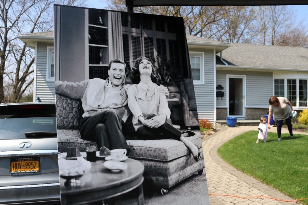
Most recently updated on March 26, 2024
Partially driven on July 19, 2023
Originally posted on April 14, 2021
Today is the most urbanized leg of our 60-day journey but not before we check out one of the country’s pioneering suburban communities.
We head out of Philadelphia in the same direction along Interstate 95 as we did yesterday morning.
Just before I-95 makes that abrupt turn to cross the Delaware River into New Jersey, we steer straight ahead onto Highway 13.
An hour after departing downtown Philly, we exit the highway and arrive at Levittown, Pennsylvania, a town of 52,000 residents that has a place in modern suburb history.
The community was built by Levitt and Sons Inc., a construction company managed by William and Alfred Levitt.
The brothers, along with their father, had started their construction career during the Great Depression by building custom homes for upper-income families. During World War Two, the company constructed homes for the U.S. Navy in Norfolk, Virginia.
After the war, the Levitt brothers built their first subdivision in 1947 on Long Island, New York. They called it Levittown and marketed it as a place for middle class households.
They created an assembly line style of production where specialized workers went from home to home. By 1951, they had built 17,447 homes in the New York location.
That same year, the brothers purchased 5,700 acres of spinach and broccoli farmland outside Philadelphia near where a U.S. Steel plant that would eventually employ 10,000 people was being built. The Levitts saw an opportunity here with a demand for housing and new low-interest government loans.
In 1952, they started construction on their second Levittown. There were six basic types of models. The houses were priced at about $9,000. The down payments were as low as $100 and monthly payments were as little as $60. By 1958, 17,311 homes were finished in this new Levittown.

Levittown, Pennsylvania, one of the nation’s first suburbs. Photo by Britannica.
The suburb grouped neighborhoods by incomes levels with streets that began with the same letter. The Levitt company also built elementary schools, churches, public pools, parks and greenbelts.
However, the Levitts did not sell houses to African-Americans. The prohibition was actually written into the lease agreements. In 1953, the 70,000-person town was the largest community in the United States with no Black residents.
In 1957, a Black couple, William and Daisy Myers, and their three children purchased a house from an existing homeowner. They moved into the residence at 43 Deepgreen Lane, becoming the town’s first African-American residents.
The newcomers were not welcomed by everyone. About 2,000 Levittown residents signed a petition against the Myers’ purchase. Demonstrations with up to 300 people were held outside their home. In one instance, a window in the Myers’ home was broken when a rock was thrown through it. State authorities eventually stepped in to quell the harassment. The Myers moved out in 1961.
The Levitt company plowed ahead. In 1958, they started building a third Levittown, now known as Willingboro, across the Delaware River in New Jersey. William Levitt still refused to sell to Black families, even though the homes were near integrated military bases. African-American households were finally allowed after a series of lawsuits.
The Levitt brothers are credited with inventing the modern suburban neighborhood as well as providing some upward mobility for middle-class families. They’re criticized for not only their discriminatory policies but also producing what some consider bland, conforming communities.
Levitt and Sons filed for Chapter 11 bankruptcy in 2007, but the company’s contribution is still remembered with a historical marker in the Pennsylvania neighborhood it created.
A town that today is 81 percent white with a median household income of $90,000 and a median home price of about $350,000.
Presidents, Scientists and Racial Protests
It’s back on Highway 13 and a quick merge onto Highway 1 north.
In 10 minutes, we’ve crossed the state line into New Jersey.
The Garden State, as it’s called, is not large. Its 87,222 square miles ranks it 47th among states. However, it is 11th in population with more than 9 million people. Do the math and it’s not difficult to figure out that New Jersey indeed is the number one state in population density with 1,267 residents per square mile. About 90 percent of people in New Jersey live in urban areas.
Members of the Delaware tribe were early occupants of this region. The Dutch, Finns and Swedes were the first European settlers, arriving in the early 1600s. The British seized control of the territory in 1664. New Jersey was the third state to join the Union, after Delaware and Pennsylvania. More than 100 battles were fought in New Jersey during the Revolutionary War, the most of any state.
In the 1800s, New Jersey became highly industrialized as factories sprung up in the state’s six largest cities. Iron mining, especially in northwestern New Jersey, was one of the economic drivers. The industries attracted a flood of European immigrants.

The conditions in some of the state’s factories sparked calls for child labor and worker protection laws. The issues helped Woodrow Wilson get elected as New Jersey governor in 1910. He left that job when he was elected president in 1912.
The first passenger flight in U.S. history occurred here in May 1919 when a plane flew from New York City to Atlantic City.
The state prospered in the 1910s and 1920s, suffered during the 1930s and then prospered again in the 1940s with battleships, cruisers and destroyers being built for the war effort.
In the second half of the 1900s, New Jersey’s proximity to New York and Philadelphia helped fuel growth, especially after the New Jersey Turnpike opened in the early 1950s.
The state was the scene of racial protests in the 1960s, several of which we will examine during our travels today.
Since 2000, towns along the commuter rail lines have grown more quickly than automobile-oriented suburbs, reversing the trend of past decades where urban dwellers moved to suburban neighborhoods.
The main industry today is pharmaceuticals followed by food processing and then electronic product manufacturing.
New Jersey does have an agricultural component with 750,000 acres of farmland. Its top crop is blueberries with about 56 million pounds produced per year, which ranks 5th among states. New Jersey is also third in cranberries as well as spinach, peaches and bell peppers. Farms also produce tomatoes and strawberries.
Offshore clam beds are the number one seafood product.
The state does attract some tourism with Atlantic City and the Jersey Shore being among the top destinations. The state is also known for its diners. There are an estimated 530 of them here, the most of any state and leading to New Jersey’s proclamation that it’s the diner capital of the world.
New Jersey’s median annual household income is $97,000, one of the highest in the nation.
The state has also had its share of popular singers from Frank Sinatra to Bruce Springsteen to Jon Bon Jovi.
———————————————-
Immediately after crossing the New Jersey border, we hit the state capital of Trenton.
With 88,000 residents, it’s the 6th most populous city in New Jersey. The population is listed as 45 percent Black, 38 percent Hispanic or Latino and 13 percent white.
The Quakers first settled the region in 1679. The community was starting to grow in 1719 when it was officially established and named after William Trent, a major local landowner.
The first public reading of the Declaration of Independence occurred in Trenton before the document was formally introduced in Philadelphia. There is a mural marking this historic event on South Warren Street.
The city briefly served as the nation’s capital in November/December 1784. It was named as state capital in 1790.
In the late 1700s, Trenton developed into a shipping and transportation center between New York and Philadelphia. The city continued to grow after the railroads arrived in the 1830s and European immigrants came to work in factories that manufactured items such as pottery and wire rope. Some of the rope product was used to build the Brooklyn Bridge.
In the 1900s, factories that produced steel, rubber, ceramic and linoleum continued to fuel the city’s manufacturing industry. In the 1920s, the city adopted the slogan “Trenton Makes, The World Takes.” That motto was placed on billboards and bridges. It remains on the Delaware River Bridge today.
Manufacturing began to decline in the mid-1900s and the downtown suffered a blow during the turbulent 1960s.
In April 1968, the Trenton riots broke out the week after the assassination of civil rights leader Dr. Martin Luther King Jr. More than 200 businesses were ransacked and burned. There were 16 police officers and 15 firefighters injured as well as 300 people arrested. A 19-year-old Black college student was killed by an errant police bullet. Eventually, 200 state troopers arrived to quell the disturbance.
The downtown region never fully recovered, especially in the Blue Monument region. Stores weren’t rebuilt and insurance companies refused to insure buildings.
The city has tried to revive the core area by making it a center of state government. Every day, 20,000 state workers come into downtown.
Trenton still has some manufacturing industries that produce pottery, wheels, lighting, candles and flashlights.
However, the capital city continues to struggle economically. The median annual household income is $44,000 while the median price for a home is about $310,000.
————————————–
Another 20 minutes north on Highway 1 takes us to the town of Princeton, a community of 30,000 residents best known as the home of Princeton University.
The university, then named the College of New Jersey, moved from Newark to Princeton in 1756.
By that time, the community, which originally was the home of the Lenni Lenape tribe, had been settled for more than 75 years. It was originally named Prince-Town after Prince William of Orange and Nassau.
The settlement was a stagecoach stop in the early 1800s. A railroad and canal were built in the 1830s.
Today, the town does have pharmaceutical and publishing industries, but the economy has always been primarily driven by the university, which now has 5,500 undergraduate students and more than 1,200 faculty members. The university’s professors and other staff have collected 31 Nobel prizes over the years.

Princeton University in New Jersey was once headed by future president Woodrow Wilson. Photo by Princeton University.
It’s a primary reason the median annual household income here is $176,000, the poverty rate sits at 6 percent and the average price of a home is $860,000.
Princeton University was the setting for the 2001 film “A Beautiful Mind,” a story based on the life of Princeton graduate student John Nash who went on to teach at the Massachusetts Institute of Technology and won a Nobel physics prize in 1994 despite battling serious mental health illnesses.
Princeton University was also the home of two famous Americans in the 1900s.
The first is Woodrow Wilson, the nation’s 28th president. Wilson graduated from Princeton University in 1879. He returned to serve as university president from 1902 to 1910 before being elected New Jersey governor and then heading to the White House in 1913.
While Wilson was university president, he oversaw a $12 million campaign to transform Princeton into a full-scale university. He created an administrative structure that included departments of instruction that reported directly to him. He hired 50 assistant professors to help guide students through their studies. Wilson also tightened academic standards and introduced a curriculum of general studies for frosh and sophomore students.
There were numerous buildings on campus named in honor of Wilson, including the School of Public and International Affairs. There’s also the Woodrow Wilson Award, an honor given to an alumnus for distinguished work in public service.
However, in June 2020, the university’s board of trustees voted to remove Wilson’s name from its public policy school as well as another building on campus. The decision came after a 5-year campaign by students who said that Wilson shouldn’t be honored at the school because of some of his racist views. Among other things, they said Wilson supported separation of the races and opposed efforts by civil rights leaders to fight discrimination.

Scientist Albert Einstein’s former home in Princeton, New Jersey. Photo by Wikimedia Commons.
Other institutions across the country have also removed Wilson’s name from buildings. Officials at these facilities have noted that Wilson, who was born in Virginia in 1856, wrote a five-volume history textbook, “A History of the American People,” that romanticized the Confederacy and praised the Ku Klux Klan. Wilson also spoke at the dedication of a Confederate monument in 1914 as well as held a screening of the racial-themed film, “The Birth of a Nation,” at the White House in 1915.
In June 2022, Princeton officials announced they were renaming Marx Hall in honor of Laura Wooten, a former university employee who has been recognized as the longest serving poll worker in the United States. Wooten died in 2019 at the age of 98.
The other famous 20th century American with ties to Princeton was scientist Albert Einstein, who lived at a home on Mercer Street from 1936 until his death in 1955.
The German-born Einstein is best known for his theories of relativity as well as his 1921 Nobel prize for physics.
In 1932, Einstein, who was Jewish, fled Nazi Germany after he was hired at Princeton’s Institute for Advanced Studies. He retired from the institute in 1945 but continued to live and work in Princeton until his death 10 years later.
The Albert Einstein House is a simple two-story L-shaped home. Einstein’s study was a place where he conducted some of the best research of his later years. On his deathbed, Einstein reportedly asked his stepdaughter not to allow his home to become a museum. She honored that request. The house was designated as a National Historic Landmark in 1976.
————————————-
Another half-hour up Highway 1 is a town named for another famous American of intellect.
Edison, New Jersey, is officially a township with 107,000 residents, nearly 50 percent of whom are Asian and 27 percent of whom are white. It’s another higher income community with a median annual household income of $118,000 and poverty rate of 6 percent. The median home value is about $550,000.
It was originally established as the Raritan Township in the late 1600s. Its name was changed to Edison Township in 1954 in honor of the inventor Thomas Edison.
In 1876, Edison set up his home and laboratory in the Menlo Park section of town reportedly because it was the highest point along the Pennsylvania Railroad between New York and Philadelphia. His command post was on 34 acres he had purchased. The complex also included a carpenter’s shop, a carbon shed and a blacksmith’s shop.
In his 10 years in that laboratory, the Wizard of Menlo Park came up with more than 600 inventions and secured more than 400 patents. Among his creations in this lab were phonograph, the light bulb filament and the incandescent lamp.

The Thomas Edison Center at Menlo Park in New Jersey. Photo by Happy Family Art.
Edison’s lab was on Christie Street, which he turned into the first street in the world to be lit up by incandescent lamps. From there, he also established the Edison Electric Light Company. He eventually illuminated street lights on Pearl Street in New York City using electricity, the first time a central generating station had supplied power to a region.
Edison’s Menlo Park lab became a place where people visited to see his inventions up close.
In 1887, Edison moved his lab to a bigger space in West Orange, New Jersey, to be closer to New York City. He and his family still spent summers at the Menlo Park home.
Among his inventions in the West Orange lab were the stock ticker, motion picture camera and a mechanical vote counter.
By the time he died in 1931 at the age of 83, Edison had racked up 1,093 patents.
Edison is also credited with creating the modern invention process that combined the principles of mass production to the idea of the solitary inventor.
There is a Thomas Edison National Historic Park in West Orange.
In Edison, the site of the inventor’s home and lab are within the 36-acre Thomas Edison Center at Menlo Park. There’s a two-room museum as well as the Edison Memorial Tower, which was erected in 1937 and is surrounded by 12 replicated street lamps.
The township also has a manufacturing history.
It was home to the Ford Motor Edison assembly plant and Frigidaire air conditioning facility. Many of these industrial facilities have been shuttered since 2000. That includes the 2004 closure of the Ford factory.
In their place has sprouted a sector of e-commerce businesses.
Edison is home to a 900,000-square-foot Amazon distribution center that opened in 2017 in the old Frigidaire building. FedEx has since opened a distribution center here.
Edison also is now home to the world’s largest indoor go-kart track. The 131,000-square-foot Supercharged Entertainment complex, which opened in December 2022, includes not only a go-kart track but also 140 arcade games, bumper cars, a drop and twister tower, a restaurant and two bars.
——————————————-
From Edison, we work our way back over to Interstate 95 for a half-hour drive to the bustling city of Newark.
Newark is the most populous city in New Jersey with more than 300,000 residents. Like Trenton, it is a minority majority community. About 47 percent of the population is listed is as Black, 37 percent are Hispanic or Latino and 9 percent are white.
The town was founded in 1666 by Puritans on land purchased from the Delaware tribe. It’s one of the oldest European cities in the United States.
The settlement was awarded a charter in 1693, organized as a township in 1798 and then as a city in 1836.
Newark grew quickly in the 1800s and early 1900s as industries sprang up. They included leather tanning, jewelry and shoe manufacturing.
The construction of the Morris Canal as well as the arrival of the railroads turned Newark into a major port city. The insurance industry also got a foothold here in the mid-1800s.
The manufacturing industries have changed over the past century, but that sector of the economy is still strong. They include electronics, chemicals, leather goods, rubber, jewelry and furniture.
The Port Newark Container Terminal and Newark Liberty International Airport continue to solidify Newark’s status as a center for transportation and distribution.
The insurance industry has remained active. Prudential Financial and other outfits have headquarters here. Newark has the third largest insurance sector in the nation, behind only New York City and Hartford, Connecticut.
The city also has 1,000 law firms due to the local, state and federal offices located here. In total, more than 100,000 people commute into Newark each workday.
Newark has dealt with some serious urban issues over the past half-century.
For starters, there’s the population. The building of the New Jersey turnpike in the 1950s provided Newark residents with a way to move out of the city and into the suburbs. The population of Newark has declined from its peak of 450,000 in 1940 to its 307,000 today.
The demographics of the city changed dramatically along with the exodus. The Black population has risen from about 20 percent in 1950 to its nearly 50 percent today.
In July 1967, racial tensions exploded during five days of rioting that left 26 people dead, 1,500 people injured and $10 million property damage when buildings were burned and looted.
The demonstrations began after civil rights activists said a Black cab driver has been arrested and then beaten by police officers. Angry protesters gathered outside a police precinct. A few hours later, bricks, bottles and Molotov cocktails were thrown at the police facility.
Looting began that evening and carried into the following night. Police were told to use force to stop the rioting. One suspected looter was shot and killed. National Guard and state troops were called in. The confrontations continued over the next three days before order was restored.
The Newark riot was among a number of similar protests that occurred in major cities that summer. However, it was one of the most violent and deadliest. Some historians say the 1967 riots hasten the departure of white residents and left the impression of Newark as a dangerous city.
Since then, issues such as poverty, unemployment and substandard housing have continued to challenge the city.
The median annual household income here is slightly more than $46,000 and the poverty rate is 24 percent.
In 2018, Newark officials began a program to protect residents from the effects of gentrification as new development that includes luxury apartments and offices comes into the city. The mayor created the Equitable Growth Advisory Commission to look at issues such as land use and housing.
In 2019, a water quality crisis hit the city. It came after repeated tests showed drinking water in Newark contained high levels of lead and other toxins. At first, the city handed out water filters to homes. Then, they resorted to shipping in bottled water.
A month later, city officials announced a $120 million plan to replace thousands of contaminated water pipes over the next 30 months.
In March 2020, city officials reported progress on reducing the lead contamination, but the drinking water supply still contained lead levels above federal standards. Many residents continued to rely on bottled water.
In July 2020, city officials reported that the lead levels in water had dipped below federal standards for the first time in three years. In January 2021, a settlement agreement was reached between citizens and the city with considerable progress reported in the replacement of water pipes. In October 2021, local officials reported that the project was nearly complete with 22,000 lead-contaminated pipes replaced. The project was scheduled to take 10 years but took only about 2 years.
In February 2022, Vice President Kamala Harris visited Newark to praise state and local officials for the success of this program.
———————————————
It’s back on Interstate 95 north for our final stop in New Jersey.
Fort Lee is a half-hour up the freeway from Newark. The community of almost 40,000 residents sits at the foot of the George Washington Bridge across the Hudson River from the Washington Heights neighborhood in New York City’s upper Manhattan borough.
It’s a town with a surprisingly rich film industry. It was also the center of a political scandal in 2013 that had implications in the 2016 presidential campaign.
In its early days, Fort Lee was the site for a historical moment in the Revolutionary War.
The region was originally inhabited by the Lenni Lanape tribe. The locale was reportedly sited by English explorer Henry Hudson in 1609.
The British gained control of what was then a Dutch-ruled area in 1664. The first permanent home was built in 1756.
The settlement was named after a fort built on a bluff by General George Washington that along with Fort Washington overlooked the Hudson River.
In November 1776, Washington and his troops retreated from the forts through what is now Fort Lee to avoid capture by the British. Thomas Paine, the author of the historic pamphlet “Common Sense,” was with Washington’s Army and wrote his famous line about the retreat: “These are the times that try men’s souls.”
Fort Lee was incorporated as a borough by the state Legislature in 1904.

The George Washington Bridge as seen from Fort Lee, New Jersey. Photo by Structurae.
By then, it had emerged as a film capital. Thomas Edison had opened the country’s first film studio, “Black Maria,” in West Orange in the late 1800s. He shot his first film in Fort Lee in 1907.
Land was cheaper in New Jersey than in New York and there was an array of landscapes on this side of the Hudson River, so the film industry decided to establish itself in Fort Lee. The Kalem Company began operating here in 1907. D.W. Griffith, the creator “The Birth of a Nation,” shot his first of what would be many films here in 1908. In 1909, the Champion Film Company, a forerunner of Universal Studios, built its first film studio in town.
Some of the biggest movie stars of the early 1900s such as Mary Pickford, Lionel Barrymore and Rudolph Valentino, blossomed at studios in Fort Lee. Actress Pearl White filmed a number of “The Perils of Pauline” silent movies here, many of which had her hanging from the cliffs overlooking Fort Lee. Those scenes are the origin of the term “cliffhanger” in movie lingo.
By 1918, at least 11 film companies were operating in Fort Lee. The city’s film industry prospered for two decades. However, the first studio had been built in Hollywood in 1911 and by the 1930s, California’s climate and available land lured the film companies to the West Coast.
Film processing still remains a part of Fort Lee’s economy. The movie-making industry is starting to make a comeback, in part because of tax breaks offered by the state of New Jersey. Since 2000, the Fort Lee Film Commission has recruited production companies as well as celebrated the city’s movie history. The Barrymore Film Center opened in October 2022 as a film screening venue and museum.
The city’s economy also relies on pharmaceuticals, animal health products, animal feed and printing products. The median annual household income is a healthy $101,000 and the average price of a home is a respectable $530,000.
Since 2000, Fort Lee has seen a large migration of Korean immigrants. The influx is one of the reasons that the city is now 43 percent Asian, 38 percent white and 13 percent Hispanic or Latino.
Fort Lee was in the news a decade ago to the Bridgegate political scandal.
In September 2013, members of New Jersey Governor Chris Christie’s staff were accused of closing two of the three lanes to one of Fort Lee’s entrances to the George Washington Bridge over a four-day period. One theory for the closure is that it was retaliation against Fort Lee’s Democratic mayor Mark Sokolich, who has held that office since 2008, for not supporting Christie’s re-election bid.
Two of Christie’s aides were eventually convicted and sentenced to prison. In May 2020, the U.S. Supreme Court tossed out the two aides’ fraud convictions. A third aide pleaded guilty in 2015 and was given probation.
Although Christie was never prosecuted and said he didn’t know about the lane closures, the Bridgegate scandal shadowed him during his 2016 presidential campaign.
Cartoons, Hot Dogs and the Old Road
We leave New Jersey by crossing the George Washington Bridge.
This double-decked suspension span is the world’s busiest motor vehicle bridge, carrying more than 100 million vehicles in a typical year.
In total, the bridge is 4,760 feet long with the actual deck encompassing 3,500 feet. At midspan, it sits 212 feet above the Hudson River.
Plans for the bridge were approved in 1925 by the state legislatures in New York and New Jersey. Construction started in 1927 and the bridge opened in 1931. It was considered an engineering marvel at the time.
In 1946, the main deck was widened from six to eight lanes. A six-lane lower deck was completed in 1962 to handle the increases in traffic flow.
Today, the span is four lanes in each direction on the top deck and three lanes in each direction on the bottom deck. The pedestrian and bicycle paths are on the upper deck.
The toll for cars ranges from $13.38 to $17.63 depending on the time of day you cross. In July 2022, it was announced motorists would no longer be able to pay cash. They need that EZ pass or they will be billed in the mail after cameras recorded their car’s license plate.
Since 1948, the bridge has flown the largest free-standing American flag in the world. The flag is 90 feet by 60 feet and weighs 460 pounds. The flag is unfurled only on holidays and special observances such as the anniversaries of the September 11th terrorist attacks.
—————————————-
Coming off the George Washington Bridge, we stay on Interstate 95 and enter New York, a state we will study more in depth when we revisit it in a few days.
On today’s route, we cut through the Bronx on I-95. When we reach the western edge of Long Island Sound, the freeway makes a sharp left turn and heads north along the Atlantic coastline.
About 30 minutes after we cross the state line, we arrive at New Rochelle, a community of nearly 84,000 people that has some film and television history of its own. It also was one of the early hot spots in the 2020 COVID-19 pandemic.
The origins of New Rochelle begin in 1654. That’s when Thomas Pell purchased a large tract of land from the Siwanoy tribe.
In 1688, French Protestants known as Huguenots formed a community on 6,100 acres donated by Pell. Many of the settlers were artisans from La Rochelle, France, and named their new settlement after their hometown. A monument with the names of the original 33 Huguenot pioneers now stands in the city’s Hudson Park.
Thomas Paine, the author who was part of the Fort Lee retreat, owned a country home in New Rochelle. The estate was built in 1794 on 277 acres bestowed upon Paine for his service during the Revolutionary War. A museum and Paine’s gravesite are at what is now the Thomas Paine Cottage Museum.
For most of the 1700s, New Rochelle was an agricultural community. It began to industrialize in the 1800s with the construction of a four-story flour mill in 1801.
The New York and New Haven Railroad arrived in 1848. Remnants of those early tracks are now part of today’s commuter rail service to New York City.
In the early 1900s, the motion picture industry was a big part of the local economy.

The Dick Van Dyke show from the 1960s was set in New Rochelle, New York. Photo by the city of New Rochelle.
Thanhouser Film Corporation was established here in 1909 and produced more than 1,000 silent films. Terrytoons animation studio operated in downtown New Rochelle from 1930 to 1972, making cartoons such as Mighty Mouse as well as Heckle and Jeckle.
On the 1960s television sitcom “The Dick Van Dyke Show,” the Petrie family lived in New Rochelle at 148 Bonnie Meadow Lane. There was no such address, but the show’s producer, Carl Reiner, did live at 48 Bonnie Meadow Lane. In 2017, the City Council renamed that street Dick Van Dyke Show Way.
In addition, New Rochelle has a Walk of Fame near the city library with tributes to Carl Reiner as well as Mighty Mouse and comedian Jay Leno, who grew up in New Rochelle.
Actors Ruby Dee and Ossie Davis lived in a large home in New Rochelle for more than four decades. A park in New Rochelle is named after Dee. It’s where the Walk of Fame is located.
New Rochelle started to evolve as a suburb in the early 1900s when ranches and farms were purchased to build residential homes. The neighborhoods were marketed for their proximity to New York City. One slogan was “45 minutes to Broadway.”
Today, New Rochelle is a quiet community that is 42 percent white, 31 percent Hispanic or Latino and 19 percent Black. The median annual household income is listed as $100,000 and the median home price is about $810,000.
In recent years, New Rochelle has tried to entice millennials to move here. Among their incentives are a revamped downtown, housing and creative space for artists, bicycle sharing and Soofa benches with charging stations. There’s even an axe-throwing bar.
In March 2020, a containment zone was set up around New Rochelle in response to a surge of COVID-19 cases. New York Governor Andrew Cuomo established the one-mile circular safety area after 108 cases of COVID-19 were diagnosed in the city. At the time, it was the largest known COVID cluster in the country.
The city clamped down and reduced the spread, becoming a model on how to contain the virus.
On March 3, 2021, the city on the anniversary of the first confirmed COVID-19 case unveiled a temporary memorial inside a glass cage that included ribbons of remembrance to those who died of the disease.
————————————
We continue northbound on Interstate 95, skirting the shores of Long Island Sound as we head toward our next destination.
Along the way, we pass by Walter’s Hot Dog Stand in the small town of Mamaroneck, New York.
The eatery has been serving hot dogs since Walter Warrington established the business in 1919. It’s been at its current location on Palmer Avenue since 1928.
The hot dogs are a mixture of beef, pork and veal. They are split down the middle and served with a “secret sauce” along with Walter’s signature mustard on a toasted bun.
The Mamaroneck restaurant underwent a major renovation in 2014. In 2015, the fourth generation of owners launched the company’s first mobile food truck.
A second Walter’s opened in 2018 in White Plains, just 15 minutes north.

Walter’s Hot Dog stand in Mamaroneck, New York
On a visit on July 19, 2023 — ironically National Hot Dog Day — a dozen people were ordering hot dogs at the stand along a busy Palmer Avenue. Many were taking their lunch orders to a quiet, tree-shrouded picnic area with tables shaded by colorful umbrellas next to the eatery.
Clarise Ellis, a shift supervisor at Walter’s, told 60 Days USA that the hot dog stand receives a variety of visitors. Some are from out of state while others are regulars from town. Students at the high school across the street also visit during lunch break. Indeed, there were three high school girls at a table in the picnic area on this afternoon.
Ellis noted that they get a number of customers who went to the high school and return as adults.
“They tell us they remember coming here for lunch when they were students,” she said.
Ellis said most people order the single hot dog with the signature mustard. That’s what Megan and Mike were munching on in the picnic area when we visited. The couple from Westchester County said they had tasted the hot dogs from a food truck at a fair and liked them so much they decided to make a trip to the Palmer Avenue stand.
“Everybody talks about it, so we had to come,” said Mike.
The next town along I-95 is Harrison, an upper income community of 30,000.

The former home of aviator Amelia Earhart in Harrison, New York. Photo by Roadside America.
The median annual household income in Harrison is about $150,000. The median price for a home is $1.6 million.
The town had somewhat humble beginnings.
It was established in 1695 when John Harrison and three others acquired property in the region. The settlement was initially called Harrison’s Purchase.
The first permanent residents arrived in 1724. The railroad came in 1848.
Harrison was never much of a manufacturing center.
The city is known more for being the home of some high profile companies, most of them located along a stretch of road known as Platinum Mile in the Purchase section of town. Both MasterCard and PepsiCo have their headquarters on that street.
Harrison was also home for a few years to aviator Amelia Earhart and her husband, George Putnam. They lived in a 16-room home on Locust Street, which has been renamed Amelia Earhart Lane. A monument was placed in Station Park in 1932 to commemorate Earhart becoming the first woman to fly solo across the Atlantic Ocean. Earhart disappeared while on an around-the-world flight in 1937. The home she and her husband lived in is still there.
—————————————–
We drop off Interstate 95 and hop onto northbound Highway 1 for the final section of today’s journey.
There’s a good reason.
Highway 1 is part of what used to be the Boston Post Road.
The road was the nation’s first thoroughfare, running from New York to Boston.
It covered 250 miles, mostly following paths used by Native American tribes.
The road was divided into three sections – the Lower Post Road, the Middle Post Road and the Upper Post Road. It eventually became part of The King’s Highway, a 1,300-mile road completed in 1735 from Charleston, South Carolina, to Boston.
The first segment was Upper Post, which was laid out in 1673.
The route was mainly used by horseback riding postal carriers. Some of them also delivered the Boston News-Letter, the nation’s first regularly published newspaper.
The first long-distance stagecoach service started on Upper Road in 1783.
In 1789, President George Washington took a tour of the road, leading to the famous “George Washington Slept Here” signs.
Mileposts were installed, beginning at the intersection of Broadway and Wall Street in New York City, in 1753 by Benjamin Franklin, who was deputy postmaster at the time.
Two of the 200-year-old mileposts labeled 24 and 25 are still standing along Highway 1 in Rye, New York, a town just south of the Connecticut border. They are part of the Boston Post Road Historic District, a 286-acre region that also includes the estate of John Jay, the nation’s first chief justice of the Supreme Court.
Much of the Boston Post Road is now Highways 1, 5 and 20, although some parts are still called The King’s Highway.
We glide along that roadway past Rye and into Connecticut.
We stop at the first town we encounter just 10 minutes after crossing the state line.
That would be Greenwich, part of Connecticut’s panhandle as well as its Gold Coast.
There’ll be a lot more to uncover tomorrow as we spend the entire day crisscrossing The Constitution State.