
Day 52: The ‘Rocky’ Road Through Colorado and Wyoming
May 10, 2021
Day 50: ‘Rushing’ Through South Dakota
May 8, 2021
Most recently updated on February 21, 2024
Originally posted on May 9, 2021
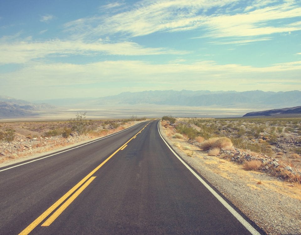
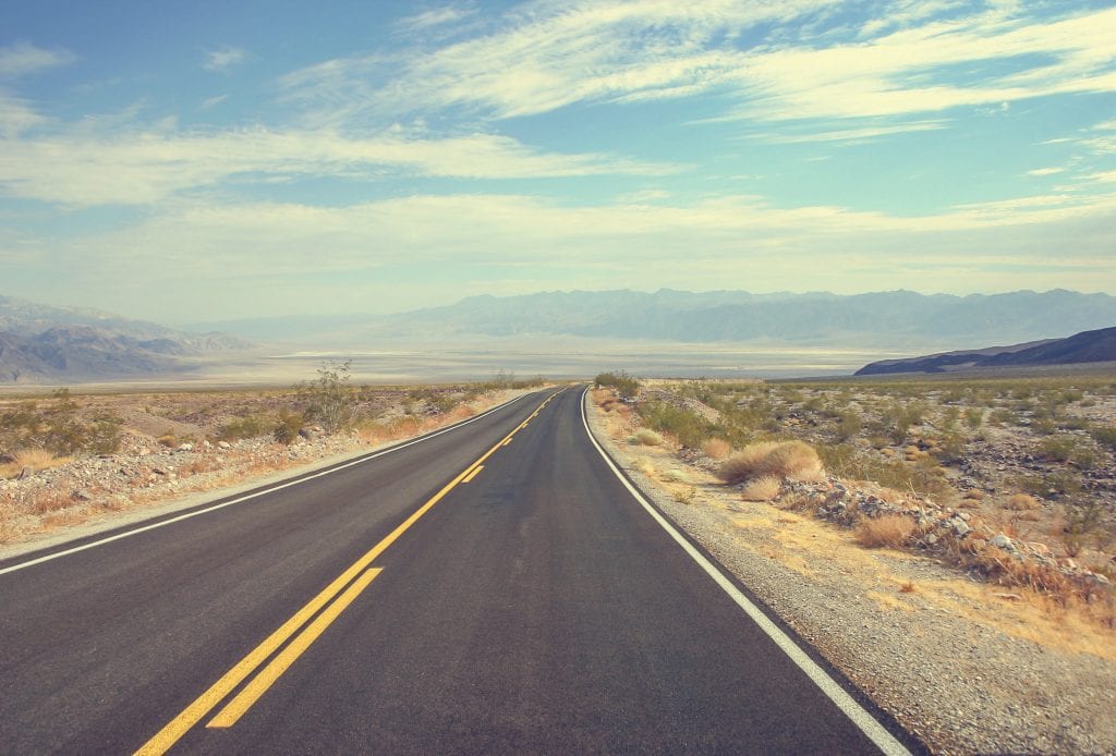
We transition today from the Midwest to the West.
Our travels will take us on Day 51 to some prehistoric bones and a fur trade museum before we end on a high note in a Rocky Mountain city.
We leave Rapid City by heading south on Highway 79 through the southwest corner of South Dakota. In about 45 minutes, we come across Buffalo Gap.

This community of about 160 people was once a stage stop along the Sidney-Deadwood Trail for the Northwestern Stage Company during the 1875-76 Black Hills Gold Rush. It was named for the gap in the mountains that sheltered buffalo herds.
A railroad spur for the Fremont, Elkhorn and Missouri Valley Railroad arrived in 1885, spurring the construction of a railroad station. The railroad line served travelers headed to the Black Hills and other nearby areas.
The railroad made Buffalo Gap one of the busiest cattle shipping points in the nation. The population rose to 1,200 people, making it was one of the largest towns in South Dakota. During that time, the settlement had 140 businesses, including 17 hotels and restaurants, four general stores, a hardware store, a clothing store, two drug stores, a furniture store, a bank, four Chinese laundries and 23 saloons. Local business owners hired a town marshal to keep the peace.
Beef prices fell in 1885 and the overgrazed land didn’t produce like it had in the past. A summer drought in 1886 and harsh winter in 1887 sent Buffalo Gap’s economy into a tailspin. A fire in 1895 destroyed most of the downtown businesses and many weren’t rebuilt. The population plummeted to 280 by 1910.
Nonetheless, an auditorium was built to hold regional activities and the Nolan grain elevator went up in 1926. The town still served as a cattle depot, but in the 1930s, the Great Depression, a new highway outside of town and the Dust Bowl hit the economy hard once more and the population dwindled again. In 1938, the railroad spur was discontinued and cattle stopped shipping in 1953.
Many businesses closed in the 1960s, although the grain elevator is still in operation as is the Rancher Feed and Seed store. It’s run by Sara Beard, who grew up in the area and returned in 2015 after earning a degree in economics to take over operations of the store.
——————————–
After departing from Buffalo Gap, we turn west on Highway 18 to catch a little more Western flavor.
In just 15 minutes, we arrive at Hot Springs, a town of 3,700 people known for its soothing waters and its large prehistoric bones.
Several centuries ago, the Lakota and Cheyenne tribes fought for control of the region because of its warm spring water.
In 1875, two scientists studied those thermal waters and arrived at a geological answer. Five investors met in 1881 to form a warm water resort. The town was established and named Hot Springs in 1882. Health resorts were built and the number of visitors started to increase in 1883.

The Mammoth Site of Hot Springs in South Dakota has the largest collection of mammoth remains in the world. Photo by Black Hills.
In 1890, the Fremont, Elkhorn and Missouri Valley Railroad built a spur from Buffalo Gap to Hot Springs. Evans Plunge with its 87-degree spring water and a pool that measured 70 feet by 200 feet was built in 1891. It is still operating today. Among its features are a steam room, a sauna, two hot tubs, water slides, a weight room, a cardio room, two pools for children and an adult lap swimming pool.
Another discovery, this one of the dry variety, has also brought visitors to Hot Springs.
The Mammoth Site of Hot Springs is an excavation site from the Ice Age that has the largest collection of mammoth remains in the world, Currently, 61 mammoth remains have been identified. Other fossils include a camel, llama, wolf and coyote.
The bones were first discovered in 1974 by a heavy equipment operator who was leveling the area for a developer who was building homes. As word spread of the discovery, scientists from various universities arrived at the site. Interest escalated after a complete skull and tusks were found.
The developer decided to sell the acreage to a group that set up the scientific site. A museum now surrounds the 14-acre property. The site primarily serves as a research institution that studies as well as preserves the prehistoric remains.
There’s another part of Hot Springs that is historic. The community has 35 sandstone buildings, all built with Lakota sandstone from quarries on the outskirts of town, in particular the Evans Quarry that operated from the 1880s to 1928.
Hot Springs is also home to a U.S. Veterans Administration hospital called the VA Black Hills Healthcare System. The facility provides care for PTSD, drug abuse, alcohol abuse and other conditions. It opened in 1907 as the Battle Mountain Sanatorium for short-term treatment of lung and respiratory illnesses.
Four other sanitoriums operated in the region in the early 1900s.
The Miss South Dakota pageant was held every year for seven decades in Hot Springs at the Mueller Civic Center. The tradition ended in 2018 when the contest was moved to Brookings, the town we passed through on Day 49.
Fur and Sugar
We head south again out of Hot Springs on Highway 18 and then Highway 385.
In less than an hour, we cross into Nebraska for a second time. Today, we are traveling through the Nebraska Panhandle, a region we explore in more detail along with other panhandles in a feature article on the 60 Days USA site.

Within minutes, we arrive at Chadron, a community of 5,300 people in the northwest corner of Nebraska that has some real western flavor to it.
Native tribes, including the Cheyenne and the Oglala Lakota, lived in the region for thousands of years.
Cattle ranchers settled in the area in the 1870s. Homesteader Fannie O’Linn encouraged businesses to set up shop to serve the ranchers and nearby rural farmers. The town was officially established in 1885 when the Fremont, Elkhorn and Missouri Valley Railroad laid down tracks for its Omaha to Wyoming route. It was named for Louis Chartran, a fur trader who was married to a Native American woman and built a fur trading post here in 1841.
One of the first settlers was Charles Henry King, who established retail and freight businesses along the railroad line. One of his sons, Leslie Lynch King, moved to Omaha, where he had a son, Leslie Lynch King Jr., who moved with his mother to Grand Rapids, Michigan. The junior King eventually took his stepfather’s name, becoming Gerald R. Ford and eventually was sworn in as U.S. president in 1974.

The Museum of the Fur Trade near Chadron, Nebraska. Photo by Visit Nebraska.
During the 1893 World’s Fair in Chicago, Chadron was the starting point for the 1,000-mile Chadron-Chicago Cowboy Horse Race, won by John Berry in 13 days, 16 hours.
A drought in 1890s and an economic downturn depressed Chadron’s economy. Chadron State College was founded in 1910 and helped revive the local economy
The Pine Ridge Job Corps Civilian Conservation Center was established in 1965 and helped boost the local economy as did the U.S. Forest Service’s decision to move its office in Lincoln, Nebraska, to Chadron in 1966.
The town today is principally a service center for the surrounding agricultural area that produces wheat, alfalfa and cattle
The region is home to the Museum of the Fur Trade, which is located about 3 miles east of Chadron on Route 20. The museum has 6,000 artifacts, including the oldest known point blanket from 1775 as well as guns owned by Kit Carson and Tecumseh and crop seeds from Native American tribes from 125 years ago. The museum is located at the James Bordeaux’s trading post for the American Fur Company, which was built in 1837. The museum was founded by Charles E. Hanson Jr., who grew up on a Nebraska farm and was fascinated by history.
Chadron also holds a Fur Trade Days in July with the World Championship Buffalo Chip Throw.
——————————————–
The Nebraska Panhandle isn’t a small place, so we have more than an hour and a half of driving before our next stop.
This part of the route takes us south once more on Highway 38 before we turn west on Highway 26. That roadway brings us to Scottsbluff, a community of 14,000 with a sweet history.
The region was occupied by native tribes for centuries. In 1800s, it was also part of the pathway for travelers using the Oregon, California and Mormon trails as well as for Pony Express riders.
The first white settlers arrived about 1890. The town was founded in 1899 when the Burlington Railroad completed its extension into town. It was named after Scotts Bluff across the North Platte River, the high mountainside that was named after Hiram Scott, a fur trader who was found dead at the age of 23 in 1828 near the bluff.
In the late 1890s, the “big ditches” known as the Laramie and Tri-State irrigation canals were built here.
In 1919, the Great Western Sugar Company built its factory in town to process the thousands of acres of sugar beets grown in the area. The plant is now part of the Western Sugar Cooperative, which consists of more than 800 growers and shareholders in Nebraska, Montana, Wyoming and Colorado. The cooperative consists of four processing facilities, seven storage locations and 44 beet receiving stations. More than 1,000 people are employed by the organization.
The Kelley Bean Company has a factory here that produces dry, edible beans. Operations began in 1927.
The Scotts Bluff National Monument is 3,000 acres of unusual land formations that rise over flat prairie lands.
Entering the West
From Scottsbluff, we take a sharp turn due south on Highway 71 and then Highway 52 for another 2-hour drive.
A little more than halfway through this segment, we leave Nebraska and cross over into Colorado. Even though we’ve had experienced a lot of western-style culture so far today, I’ll officially declare at this juncture that we have left the Midwest after 13 days and entered the West.

Colorado is the eighth largest state at 103,730 square miles. It’s 21st in population between Wisconsin and Minnesota with nearly 6 million residents. Its ethnicity breaks down to 66 percent white and 22 percent Hispanic or Latino along with 4 percent Black and 3 percent Asian.
Colorado, known as The Centennial State because it was admitted to the Union in 1876, has a mean elevation of 6,800 feet, the highest of any state. In fact, its lowest elevation is 3,315 feet, also tops among states.
The United States laid claim to the eastern part of the state with the Louisiana Purchase in 1803. There was a dispute with Spain over the western half. That issue was settled with the U.S. purchase of Florida from Spain in 1819, which allowed Spain to continue to oversee some of Colorado. Mexico gained independence from Spain in 1821 and the United States was granted the rest of Colorado in 1848 after the Mexican-American War.
The Rocky Mountains cut through the state. The eastern part of Colorado consists of the high, western edge of the Great Plains while the western half is rugged mountain territory. The state’s mountains are the headwaters for six major rivers. On the western side is the Colorado River. On the eastern side are the Rio Grande, Arkansas River, North Platte, South Platte and Republican rivers.
Colorado is now in a legal fight with neighboring Nebraska over that state’s plan to divert more water from the Colorado River basin.
Overall, Colorado is socially liberal.
In 2012, Colorado became the first state to legalize recreational cannabis use. In 2021, the governor signed legislation that expands access and use of cannabis-based medicine in schools.
In 2014, state officials instituted same-sex marriages.
In 2016, Colorado voters approved an assisted suicide law. It’s only one of 9 states that has a death with dignity statute.
In November 2018, Colorado became the first state to elect an openly gay governor.
—————————————————
The first town we hit in Colorado is Fort Morgan, which lies along Interstate 76 where it intersects with Highway 52.
This community of more than 11,000 with a population that’s 49 percent Hispanic or Latino and 41 percent white sits at 4,324 feet elevation with an economy that has been powered by sugar and meat.
Native American tribes lived in the region beginning in 1000 A.D., fishing and hunting buffalo.
Fort Morgan was established in 1865 along the Overland Trail. The site was chosen on Morgan Flats for its view of the entire river valley. A fort was built to protect travelers and supplies going to and from Denver. The fort also protected the nearby mining towns from raids by local tribes who were seeking revenge for the Sand Creek Massacre in 1864.
The site was named in 1866 after Col. Christopher Morgan, who had died from a gas leak at a St. Louis hotel. The fort closed in 1868 after Union Pacific Railroad laid tracks north of town. The Colorado Central Railroad arrived in 1880 with the Chicago, Burlington and Quarry Railroad coming in 1882. The town was settled in 1884 by former military personnel.

The Cargill meatpacking plant in Fort Morgan, Colorado, was a COVID-19 hot spot during the first year of the pandemic. Photo by the Denver Post.
Fort Morgan has been primarily a shipping and processing center. It did have some economic activity after oil was discovered in the nearby Denver-Julesburg Oil Basin in 1950. Manufacturers here produce hand tools, irrigation pipe and concrete products. Agricultural products have included potatoes, beans and corn from 750 farms in the county that get irrigation water from the South Platte River.
The big agricultural product in 1900s was sugar beets. There were 1,000 acres of beets in Colorado in 1899 and 210,000 acres in 1929 with almost 20,000 acres in Morgan County.
Germans had migrated to the area because they knew the beet industry, but this produced tension during World War One. The Ku Klux Klan also had a resurgence in the 1920s, targeting Catholics and ethnic groups. Mexican immigrants worked in the fields and were treated poorly, so much so that in 1945 a Mexican consul wrote Fort Morgan’s mayor.
Great Western Sugar had a plant in Fort Morgan before the company went bankrupt in 1985. The factory is now operated by the Western Sugar Cooperative with 225 employees. It’s the only one left of the more than 20 sugar refining factories that once operated in Colorado.
Cargill has a meatpacking plant here. Many of the 2,000 workers are Muslim, most from Somalia, who arrived starting in 2005 as part of a relocation program. Tension emerged in 2014 over jobs. White and Latino applicants received a settlement of $2.2 million in back wages in a race-based discrimination lawsuit. In 2016, 138 Muslim employees of Eastern African descent sued, saying the company was curtailing their prayer time. The company settled for $1.5 million in 2018.
The meat plant was also a COVID-19 hot spot during the initial outbreak in spring 2020. In April 2020, the plant reported 23 confirmed cases and one death. The disease also spread to the community. In May 2020, Morgan County had the highest infection rate of any place in Colorado. The two mortuaries in the county ran out of space to store bodies, so a refrigerated truck was brought in to Fort Morgan to help.
In October 2023, the company announced it will spend $40 million to build 150 units of employee housing in town. The homes will be available in January 2025.
At Fort Morgan High School, educators have been encouraging integration of cultures to help unite their community of ethnic diversity.
Another organization, OneMorganCounty, doing the same. It describes its mission as “fostering relationships among diverse people and organizations to strengthen the well-being, safety and cohesive nature of our community.” They do this with programs, events and community engagement.
Fort Morgan is the hometown of one well-known musician.
Big band leader Glenn Miller grew up here, attending high school at Abner S. Baker School. Miller reportedly once played trombone on the roof of the school. The school burned down and an elementary school took its place. The city sponsors a Swing Fest every year in Miller’s honor.
—————————————
We swing back onto Interstate 76 for the final leg of today’s journey.
As we approach The Mile High City of Denver, the Rocky Mountains come more sharply into view.
This dramatic mountain range stretches 3,000 miles from British Columbia through Idaho, Montana, Wyoming, Utah, Colorado and New Mexico. It actually consists of 100 ranges.

The Rocky Mountains in Colorado. Photo by GoodFreePhotos.
The highest elevation in the range is 14,440 feet at Mount Elbert in Colorado. The Rockies vary in width from 70 to 300 miles. The Continental Divide, the line where waters flow either toward the Atlantic or the Pacific Ocean, is in this range.
The mountains formed 55 million to 80 million years ago during tectonic plate shifting. Since then, glaciers and other ecological activity have shaped the mountains. After the last Ice Age, humans began to inhabit the terrain. Explorers such as Lewis and Clark came through in the early 1800s.
The Rockies’ minerals and fur trade drove economic expansion. The minerals included gold, silver, copper, lead, tungsten and zinc. The range also contains deposits of oil, coal and natural gas.
Although the mountains themselves have never been densely populated, the cities near them have grown, especially since 1950.
There are environmental challenges. Timber harvesting, grazing, oil exploration and mining have led to slope erosion, trace amounts of metal being released into streams and loss of wildlife habitat. In addition, climate change is causing a host of problems from drought to insects to wildfires.
Most of the range is still protected by dedicated parks and forest lands. The mountains are popular now for hiking, camping, mountain biking, fishing, skiing and snowboarding. The national parks include Yellowstone, Glacier and Grand Teton. The Rocky Mountain National Park in Colorado has numerous hiking trails and the Trail Ridge Road, a 48-mile highway that reaches 12,183 feet in elevation.
Getting Down in Denver
We take that Rocky Mountain High all the way into Denver.
The Mile High City is the most populous community in Colorado with 717,000 residents. It’s the 19th most populous city in the country as well as the most populated city within a 500-mile radius. Its population listed as 54 percent white, 29 percent Hispanic or Latino and 9 percent Black. The median age is 34.
Among other things, Denver has its own flower, a bunch of cannabis shops and a place in the history of what’s known as fast casual restaurants.
The city was founded in 1858 and incorporated in 1861. Things really got going here during the 1858 Pike’s Peak Gold Rush. During that time, speculators from the Kansas Territory placed cottonwood logs on a bluff overlooking the confluence of the South Platte River and Cherry Creek to stake their claims.
General William Larimer named the place Denver City to placate Kansas Territory Gov. James Denver, although Larimer didn’t know that Denver had recently resigned. Larimer still sold lots to build the town.

Denver has had a thriving flower industry for decades. Photo by Kevin J. Beaty/Denverite.
Early Denver was a true frontier town. It serviced miners with gambling halls and saloons as well as livestock and goods trading. In 1859, the Leavenworth & Pike’s Peak Express started an overland wagon service to Denver that cut the western travel time from 12 days to 6 days. In 1863, the Western Union railroad made Denver its western terminus. In 1870, Denver started its own railroad and connected it to the Transcontinental Railroad in Cheyenne, Wyoming. The Kansas Pacific Railroad arrived soon after.
There wasn’t much gold discovered, but a silver strike started an economic boom. The city grew quickly with upper income people building mansions and lower income people looking for work. A lot of German, Italian and Chinese immigrants came to town seeking jobs. In 1893, the Silver Crash ended the boom, but the city bounced back.
From the 1880s to 1930s, Denver’s flower industry flourished, especially with the cultivation of the carnation. The floral sector began in 1872 when an irrigation ditch was dug from Platte River Canyon into town. In 1891, the first greenhouse was built. By 1900, there was 400,000 square feet of greenhouse glass in town.
Denver Wholesale Florists formed in 1909. In 1921, the Denver carnation received attention and that particular industry flowered, literally. Denver was still the leading carnation producer in the world in 1974, but Colombian flower growers cut into that market. Denver has shifted to cut flowers such as roses and potted plants such as poinsettias.
Due to Denver’s central location and its size, it remains a center for storage and the distribution of goods. Its locale also makes the city a communication center because it can transmit information during business hours to both coasts. The city’s elevation allows it to be the largest city capable of a “one bounce” satellite link.
The city has also been a pioneer in fast casual restaurants with Chipotle, Quiznos and Smashburgers being founded here.

Denver has a large number of recreational cannabis shops. Photo by the Oasis Cannabis Superstore.
Medicinal drugs are also part of the city’s economy. Since Colorado was the first state to legalize recreational marijuana, there are a number of cannabis-related businesses in Denver that did $475 million in sales in 2022. That figure, however, was 30 percent lower than 2021, following a trend of declining cannabis sales in many areas of the country.
Nonetheless, the city has the highest concentration of recreational marijuana stores in Colorado. One of the more popular here is The Joint By Cannabis. The menu includes a wide variety of flowers, edibles and concentrates. In April 2022, JAD’s Mile High Smoke became the first place in Colorado where customers could buy cannabis and then consume it on site.
In May 2019, Denver became the first city to decriminalize psychedelic mushrooms, adding to its medicinal economy. The law didn’t legalize the magic mushrooms. It just made possessing or using them a minor offense. Nonetheless, the Denver Post reported in August 2019 that an underground business was starting to, well, mushroom. In April 2021, the Los Angeles Times reported that the fears over rapid psychedelic use of the plants haven’t materialized. Instead, people in Denver are growing the mushrooms in private without fear of arrest and therapists are quietly prescribing them for mental health treatments.
Another thing that is legal now in Denver are pit bulls. In November 2021, Denver voters approved a law that repealed a 31-year ban on the specially bred dogs. The animals are now allowed if the owner obtains a permit.
Like a lot of cities, Denver is also grappling with an increase in gun violence. In 2021, there were 96 homicides recorded here, the most since 1981. Cases declined in 2022 with 88 homicides reported, although the number of non-fatal shootings rose. In 2023, the city recorded 72 homicides.
Denver’s recent growth has caused some infrastructure problems, including water shortages and air pollution.
The Denver Water system serves 1.5 million people and has set up water shortage preparedness plans. In early 2021, water officials said the area was experiencing serious drought conditions and they were enforcing measures such as restricting lawn watering to 3 days a week and discouraging the use of water to clean sidewalks and other concrete surfaces. Ironically, Denver was experiencing its most spring rain in 80 years, but the rest of Colorado was facing serious drought conditions. In 2022, Denver water officials continued to enforce water restriction rules. The rules remained in place in spring 2023. The city reported plentiful rainfall in June and July 2023, resulting in residents using considerably less water than in years past. Colorado officials also said the entire state was drought free for the first time since 2019.
Environmentalists have raised concerns over the “brown layer” of air that was becoming more common in Denver’s skies. In April 2022, the Denver metropolitan area received an “F” grade from the American Lung Association for its air quality. In September 2022, federal officials said the air quality in the Denver region had deteriorated, going from “serious” to “severe.” In May 2023, officials reported that the city’s air quality was continuing to decline.

Larimer Square is a popular place to shop and dine in downtown Denver. Photo by Joe Amon/The Denver Post.
Pollution or not, there are a number of sights you can see when you visit Denver.
One is the U.S. Mint, which opened in 1863 as an assay office and started manufacturing coins in 1906. It now supplies half the nation’s coins and is the second largest gold depository in the country behind Fort Knox, Kentucky, a place we discussed on our Day 21 travels. The Denver facility is one of five mints in the country. The others are in San Francisco, Philadelphia, West Point in New York and Washington, D.C. The mint in the nation’s capital is the only one that prints paper currency. The other mints produce coins.
There’s also Larimer Square, a collection of shops, restaurants and nightlife in what used to be the pioneer town of Auraria. The square is situated on Larimer Street between 14th and 15th streets. It’s the city’s oldest and most historic block.
Denver is also the locale for the Molly Brown House Museum. The complex is located in the Capitol Hill district downtown. It was once the home of Margaret “Molly” Brown, the “unsinkable” survivor of the Titanic disaster and an active suffragette. This is the second Molly Brown house we’ve visited on our journey. We stopped by her childhood home in Hannibal, Missouri, on Day 41.
Finally, we have the Rossonian Hotel, which is closed while undergoing a major renovation. The hotel first opened in 1912. From the 1920s through the 1950s, it became known as the hotel that allowed Black entertainers such as Duke Ellington, Louis Armstrong and Nat King Cole to stay overnight when other hotels wouldn’t. The Rossonian was one of 80 hotels listed in the “Negro Motorist Green Book.” This is the second Green Book facility on our itinerary. The first was the Harriet Cornwell Tourist Home in Columbia, South Carolina, that we checked out on Day 17.
The Rossonian was named a historic place in 1995. It closed in 1998 and was purchased by Palisade Partners in 2017. The current plans call for a ground floor restaurant and a basement venue for jazz and other music. Floors two through four will contain 88 hotel rooms.
Seems like a good place to bunk at the end of Day 51.
Tomorrow, we’ll visit a high school that was the target of a famous school shooting as well as some Colorado towns known for beer, tea and a main street that inspired Walt Disney before we venture in the wide open spaces of Wyoming.