
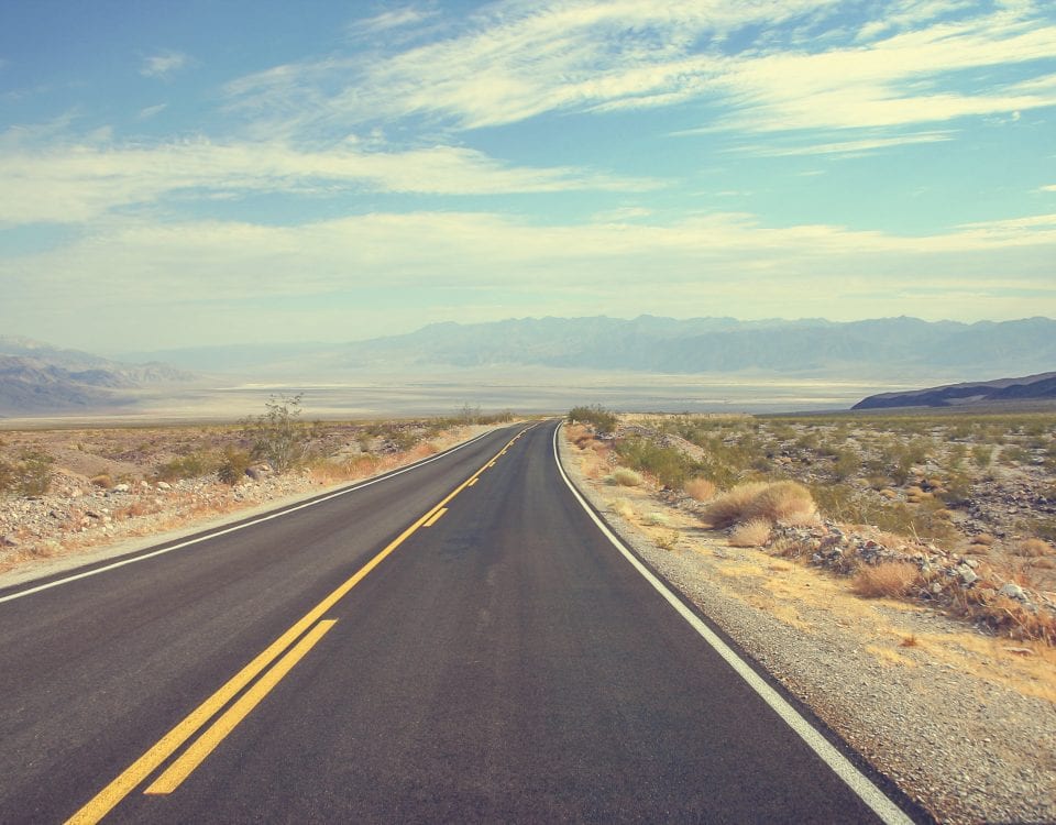
Day 56: Salt, Railroads and Bridge Jumps
May 14, 2021
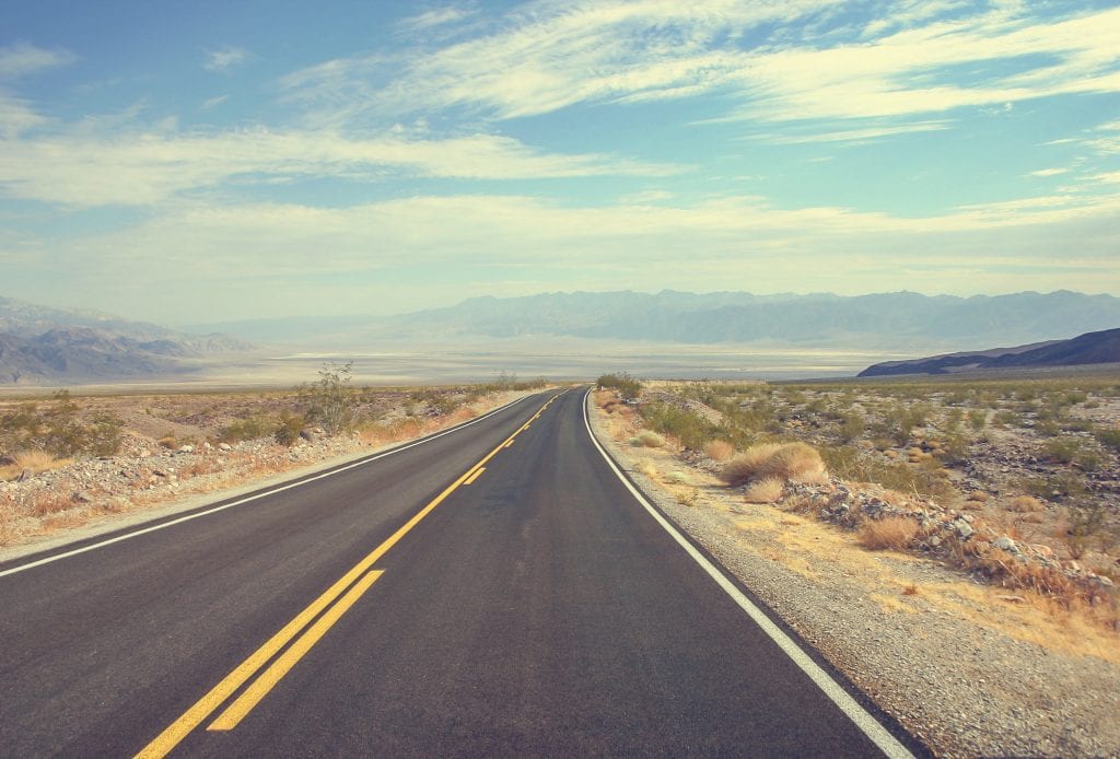
Day 54: Motoring Through Montana on the Way to Yellowstone
May 12, 2021
Most recently updated on February 25, 2024
Originally posted on May 13, 2021
Potatoes. The nation’s skinniest town. One of the country’s oldest dog sled races.
A lot to see as Day 55 unfolds. However, before we get rolling too far, we have to spend a little time in one of the world’s great natural beauties.
So, we take a drive through the western entrance to Yellowstone National Park. In doing so, we officially enter Wyoming for a second time. It’s the fourth state where we’ve made multiple visits, the others being Pennsylvania, New Hampshire and New York.
But let’s focus on where we are at the moment.
Yellowstone Park is 28,000 square miles, mostly in Wyoming with parts in Idaho and Montana.
Half of the world’s geysers are in Yellowstone. The park also has the largest concentration of mammals in the 48 states. It’s home to bears, antelope, elk and bison.
The bison herd is the oldest herd in the United States. It also has been flourishing. There are now an estimated 4,800 of the animals in the park. In fact, there may be too many of the majestic creatures here. In recent years, hundreds of bison have been trucked from the park to tribal lands in Montana.
The number of wolves has also been growing since they were reintroduced to the park in 1995. The number had grown to an estimated 94 wolves in 2020. In January 2022, it was reported that 20 of the wolves had been killed by hunters after they roamed outside the Yellowstone park boundaries. Nonetheless, the wolf population keeps rising. At least 108 wolves in 10 packs remain in Yellowstone, a number that is still low enough to worry environmentalists.
Yellowstone is one of few places where black bears and grizzly bears co-exist. In fact, there have been concerns the grizzly bear population might be thriving a bit too well. It’s estimated more than 1,000 of the bears live in the greater region with 150 to 200 of the creatures with home ranges at least partially in the park.

The Old Faithful geyser during one its many eruptions. Photo by Yellowstone National Park.
In 2018, a legal dispute erupted over the state’s plans to allow grizzly bear hunting in Yellowstone for the first time since 1991 to help thin the herd. The concerns increased in 2019 when grizzly bears roamed into Montana basins, attracting tourists. In 2020, however, a federal court ruled against the scheduled hunts, saying the bears remain protected under environmental laws.
Native Americans lived in the park region for 11,000 years.
In 1872, Yellowstone Park was established by the Grant administration, making it the first national park in the world. By 1915, there were 1,000 automobiles entering the park every year, prompting officials to ban horses for safety reasons.
There is no shortage of things to see as you drive through the expanse.
The best known is Old Faithful, the reliable geyser that was discovered in 1870. The geyser spouts every one to two hours, a total of an estimated 1 million times since 1872. The eruptions last from 1.5 to 5 minutes with water shooting from 108 to 184 feet with an average of 130 feet. Each eruption spews between 3,700 to 8,400 gallons of water. Don’t get too close, though. The water temperature is about 200 degrees.

The Grand Canyon of the Yellowstone. Photo by the National Park Service.
There’s also the Yellowstone Lake with a surface area of 132 square miles. It’s one of the largest high-elevation lakes in North America. The lake sits mostly in the Yellowstone Caldera, which is still active and one of the largest super volcanoes in North America.
The park also contains the Grand Canyon of the Yellowstone. The cavern is 20 miles long from Upper Falls to Tower Falls to Lower Falls. The canyon was formed 640,000 years ago when a volcanic eruption emptied out a large underground chamber of magma. The canyon has changed over time as rock and sediment have filled in and rivers have carved it out.
There’s also Mammoth Hot Springs, a limestone formation that looks like a cave turned inside out.
The park has 308 permanent year-round employees. That total rises to 750 during the summer. There’s also 3,200 people working for concessionaires during the peak summer months during a typical year.
If you want to spend the night here, there’s the Old Faithful Inn, one of the few log hotels left in the United States. It’s one of a number of lodges and cabins inside the park.
————————————–
We can’t stay long as there is a lot ahead on our itinerary today.
So, we exit the park and head south on Highway 20, the longest road in the country that we highlighted during our Iowa visit on Day 45 of our virtual trip. We’re only on Route 20 for a few minutes when we leave Montana and enter Idaho.

The Gem State is the 11th largest in the country at 82,751 square miles. Its population of nearly 2 million ranks it 37th among states, a slot ahead of Nebraska.
Idaho has 80 mountain ranges, giving it a mean elevation of 5,000 feet, the 6th highest among states. Its high point is 12,662 feet and its low point is 710 feet. Nothing even approaching sea level here.
The region became part of the United States with the signing of the Oregon Treaty of 1846, which ended the joint occupation of the Oregon Territory by the United States and the United Kingdom that been going on since 1818. The treaty also established the border between the United States and Canada at the 49th parallel west of the Rocky Mountains
The Idaho Territory was organized in 1863 and Idaho was admitted as the nation’s 43rd state in 1890.
The Idaho panhandle associates itself with eastern Washington and uses the Pacific Time Zone. The rest of the state is in the Mountain Time Zone.
The U.S. Forest Service manages 38 percent of Idaho’s land, the most of any state. In 2017, the forest service and Idaho reached 10 agreements for logging and restoration that proponents say will create jobs and reduce the severity of wildfires.
The state’s economy is powered by agriculture, manufacturing, mining, forestry and tourism. Idaho’s potato industry produces about one-third of nation’s crop with 11 billion pounds. There are 30 varieties of potatoes grown on 300,000 acres. Idaho is also among the top states in trout sales.
The state is home to the Idaho National Laboratory, which is managed by the U.S. Department of Energy and is a leader in nuclear energy research and development.
Liquor Licenses, Sled Races and Potato Seeds
There aren’t many towns like Island Park, at least in how they’re configured.
The community of less than 200 people is just a half-hour from West Yellowstone with U.S. Route 20 splitting it down the middle.
Island Park is mostly a retirement and vacation spot with a median age of 64 years and an elevation of 6,290 feet.
Most intriguing is the fact the town is 36 miles long but less than a mile wide. There’s a solid business reason for that. We’ll explain in a moment. First, some history.
Island Park is part a huge volcanic crater that stretches into Montana. The Island Park Caldera is 18 miles by 23 miles, one of the largest calderas in the world. The volcano had a violent eruption about 500,000 years ago with evidence of fallout recorded as far away as Kansas.
The Shoshone tribes originally lived in the region with Crow and Flathead tribes using the area for hunting.
In 1810, Andrew Henry led an expedition to the region and built Fort Henry in the St. Anthony area south of Island Park. In 1818, a party of trappers visited the area and camped along Henry’s Fork of the Snake River. One of the first pioneer settlers here was Gilman Sawtell, who built a cabin on Henry’s Lake in 1868 and eventually built the first road to Yellowstone Park. Sawtell sold fish to outlying areas.
Sawtell’s home became a stage stop in 1880. George Rea built a home south of the lake and opened the first cattle ranch and trout farm in the area. He was also a hunting guide, taking President Theodore Roosevelt on some trips.
Yellowstone Park’s popularity in the late 1800s and early 1900s brought more visitors to town. In 1902, three owners of the Oregon Short Line Road set up the Island Park Land and Cattle Company at the so-called Railroad Ranch.
Now, for the town’s thin boundaries.
Island Park was incorporated in 1947 along Highway 20 by owners of the lodges and resorts in the area to circumvent Idaho liquor laws that prohibit sale of liquor outside of city limits. So, they drew up the town to be 36 miles long and only between 500 feet and 5,000 feet wide. Locals claim to have the “longest Main Street” in the world.
Idaho law appears to still prohibit liquor sales outside city limits (Chapter 9 of Article 23). It also mentions only one license per 1,500 residents. Island Park’s businesses must have snagged their licenses before that restriction went into effect. The law does make exemptions for golf courses, wineries and ski resorts. Liquor cannot be sold on Sundays, Memorial Day, Thanksgiving or Christmas.
Fishing is a prime activity in the rivers during the summer. Ice fishing is popular in the winter. Agriculture and cattle ranches are still major industries. Tourism is also important with 44 camp sites in Henry’s Lake State Park.
The Johnny Sack Cabin, located five miles east of town, was built in 1932 by German cabinet maker Johnny Sack. His specialty was furniture that included the bark from trees.
Henry’s Fork is a 127-mile-long tributary to the Snake River. It’s known for fly fishing. The waterway meanders near the town for most of its route here.
—————————————–
We motor southbound on Highway 20 for another half-hour until we reach Ashton, a community of slightly less than 1,000 residents that is known for its dog races and potato seeds.
Let’s start with the agriculture angle.
The first settlers arrived in the region in the 1880s, attracted by the fertile soil. Canals were dug beginning in 1889 to bring in stream water. The city’s altitude of 5,260 feet limited crops to those with a short growing season such as grain and alfalfa.

The American Dog Derby race in Ashton, Idaho. Photo by the Post Register.
In the 1920s, farmers discovered the area was perfect for seed potatoes. The short growing season keeps the potatoes small and the cold winters are ideal for the seeds. The frigid winters also clean the soil and rid it of any potato blight mold spores.
Ashton remains the world’s largest seed potato growing area. People use seed potatoes to grow a crop of regular potatoes. You simply cut off pieces of the seed potato and re-plant them in the ground.
Farming of wheat, hay, alfalfa and canola ranching are also big parts of the city’s economy. Tourism brings in 2 million visitors in a typical year. The Grand Tetons are close enough for viewing on sunny days.
The city’s tourism industry received a boost in 1905 when Union Pacific Railroad decided to extend their rails from St. Anthony to the west entrance of Yellowstone. Nearby Marysville didn’t want the tracks going through their town, so the railroad helped build Ashton. Railroad officials named the town after Oregon Short Line chief engineer William Ashton. The Yellowstone Special branch was built primarily for passenger service and only secondarily for freight. The passenger line ended in 1979 and freight service stopped in 1990.
By 1911, Ashton was booming. It had four grain elevators, a blacksmith, a meat market and two livery barns. Then, the weather helped expand the city’s tourism business.
Ashton gets an average of 6 feet of snow annually. So, during winter months, people hired dog sled teams to transport passengers and goods. In turn, a dog sled race was established called the American Dog Derby. The first race was held in March 1917. It was a 55-mile contest, but a blizzard turned the one-day affair into a three-day race. Union Pacific promoted the race and brought in special transport trains. The 1921 crowd was estimated at 10,000 people. The race was popular for decades, but it was halted in 1951.
After a four-decade absence, the dog sled competition was revived in 1993. The two-day event occurs every year in the third week of February. It’s the oldest dog sled race in the continental United States.
Mormons, Waterfalls and More Potatoes
Another half-hour drive down Highway 20 takes us to Rigby, a town of 5,800 people with a history steeped in religion.
The first settlers came in 1850 after Mormon leader Brigham Young asked 26 members of his church to settle among Native Americans along the Salmon River. The first established settlement was in 1860 in Franklin near the Utah border, the oldest permanent settlement in Idaho.
The town was founded in 1884 by the Church of Jesus Christ of Latter-day Saints. It was incorporated in 1903 and named after William Rigby, a church member and early settler.

The Jefferson County Historical Museum spotlights the work of Philo T. Farnsworth, a Rigby, Idaho, native who was one of the inventors of television. Photo by TripAdvisor.
A significant number of Rigby residents are Mormon. About 79 percent of people in Rigby say they are religious and 77 percent of them say they belong to the Latter-day Saints church. If true, that means about 4,500 of the town’s 5,800 residents are of the Mormon faith.
Idaho has the second largest Mormon population with more than 440,000 of that faith residing here. That’s about 26 percent of the state’s population. The top state is Utah with 2 million church members, comprising about 67 percent of the population there.
Idaho has 137 stakes, 1,213 congregations and 6 temples connected to the Latter-day Saints. Most members of the Latter-day Saints live in eastern Idaho.
Nearby Rexburg is home to Brigham Young University-Idaho, which was founded in 1888 as Ricks Academy.
Many residents in Rigby work for the federal government or commute to jobs in Rexburg and Idaho Falls, in particular the Idaho National Laboratory there.
Rigby does a have a place in electronic media history.
Philo T. Farnsworth, one of the people credited with inventing television, lived in Rigby from ages 12 to 17. He reportedly came up with the idea for television while plowing a field and studying the waves of crops nearby. While attending Rigby High School he showed his science teacher his first drawings for an electronic television system.
There is a display for Farnsworth at the Jefferson County Historical Museum. Rigby proclaims itself as “The Birthplace of Television”
———————————————-
Just 20 minutes down Route 20 lies Idaho Falls, a community with strong ties to the nuclear energy industry.
Idaho Falls has 68,000 residents, making it the fifth most populous city in Idaho and the most populous outside the Boise metropolitan area. Idaho Falls is considered the hub of eastern Idaho.
The region was originally inhabited by the Shoshone-Bannock and Northern Paiute tribes.
In the mid-1800s, the Idaho Falls area was sparsely populated by cattle ranchers and sheep herders. in 1864, Henry Ricketts began operating a ferry on the Snake River 9 miles north of town, serving a new tide of westward migration on the Montana Trail, a wagon road used during the Montana gold rush of the 1860s and 1870s.

Idaho Falls in southern Idaho. Photo by Sage Creek Repair.
Idaho Falls was settled when freighter Matt Taylor built a wooden bridge across the Snake River about 7 miles downstream from the ferry. By 1865, a bank, hotel, stable, restaurant, post office and stagecoach stop had sprung up near the bridge.
The town was first known as Eagle Rock. The Utah and Northern Railway was built through town and a new railroad bridge across the river was constructed in 1879. In 1891, town leaders decided to change the name to attract farmers and others, so they named it Idaho Falls in reference to the rapids below the bridge. A retaining wall for a hydroelectric plant enhanced those churning waters.
In 1895, the Great Feeder irrigation canal (then the world’s largest) was built to take water from the Snake River. The canal helped convert thousands of acres of high desert into rich farmland.
In 1949, the Atomic Energy Commission opened the Nuclear Reactor Testing Station (NRTS) in the desert west of Idaho Falls. In 1951, the 890-square-mile NRTS became the first nuclear reactor to produce useful electricity. On July 17, 1955, the nearby town of Arco became the first city powered by nuclear energy. There is an “Atoms for Peace” historical marker in that town.
Since then, there have been 52 nuclear reactors built at the NRTS for testing. Only three of them remain active. The facility has always had a military connection, in particular in designing nuclear propulsion prototypes for nuclear-powered submarines.
The NRTS was the scene of the world’s first fatal nuclear reactor incident. It happened in January 1961 at an experimental U.S. Army reactor plant known as the Argonne Low Power Reactor. A single control rod was pulled out too far from the reactor, leading to a destructive power excursion and causing water to boil inside the core. That led to steam striking the top of the reactor, killing three military personnel. The three were buried in lead-lined coffins in different parts of the country. The reactor was cut up and buried at the site.
No radioactive waste was removed from the NRTS in the 1970s and 1980s. In fact, waste from other facilities was brought in. There were concerns about the Snake River Aquifer that sits below the facility, so in 1995 the state reached an agreement with federal authorities on limiting the radioactive waste being brought in. In 1995, nuclear waste began being transported a New Mexico facility.
The NRTS site is now the Idaho National Laboratory. As we mentioned earlier, it’s operated by the Department of Energy and employs nearly 6,000 people.
Idaho Falls still has an agricultural economy featuring barley and potatoes. However, since the NRTS opened in 1949 the city relies more on technology jobs at “The Site” and other places. The city has added retail shops, restaurants and entertainment sectors as well as a regional medical center.
The Idaho Falls Greenbelt is a city-operated parkway that extends five miles on both sides of the Snake River. There is an 11-mile Idaho Falls Greenbelt Loop that circles both sides of the river near the downtown area. Six miles of the trail are paved. The path goes by the actual Idaho Falls, a 22-foot-high, 600-foot-wide human-created waterfall.
——————————————-
The Snake River is a predominant figure in not only Idaho Falls but in southern part of the state, too.
The winding river begins at a lake in western Wyoming and travels through southern Idaho before crossing into Oregon and Washington and joining the Columbia River as that river’s largest tributary.

The Snake River as it winds its way through Idaho. Photo by GoodFreePhotos.
The Snake is 1,040 miles long. It passes through elevations of 10,000 feet before descending to 300 feet near the Columbia River. It has two large waterfalls in the Twin Falls area that we will check out tomorrow. The river’s name comes from a sign given by the Shoshone tribe that explorers misinterpreted as meaning a snake.
In the late 1800s, the river was an untamed current, but by the mid-1900s, it was put to use. The river was dammed and diverted to provide irrigation water to Idaho’s high desert lands as well as to provide hydroelectric power. Idaho Falls owns four electric plants that sell power to the Bonneville Power Administration, which then re-sells it to the city at reduce rates.
The Snake River used to produce half of the spring chinook salmon returning to Columbia River basins, but those species are nearly extinct now. In February 2024, a $1 billion plan was announced to restore the salmon population in the Snake River and other waterways in the Pacific Northwest.
———————————————
Out of Idaho Falls, we leave U.S. Route 20 and hop onto southbound Interstate 15.
This freeway is a major north-south route that travels from Interstate 8 in San Diego to Sweetgrass, Montana, a town with few people at the Canadian border, where I-15 becomes Alberta Highway 4.
Interstate 15 is 1,433 miles long and travels through 6 states– California, Nevada, Arizona, Utah, Idaho and Montana.
The initial construction began in 1961 with the bulk of the California section being built in the 1970s.
The freeway was originally designed to connect San Diego to the Mojave Desert area and increase tourist travel to Las Vegas. It now serves a major long-haul commerce route and has helped spur population growth in California, Nevada and Utah. Parts of the freeway were labeled as a “high priority corridor” in the 1990s NAFTA deal.
————————————
We’re on I-15 for yet another 30-minute segment when we arrive in Blackfoot, a town of 13,000 residents where potatoes are big business.
Trappers and traders from the Hudson’s Bay Company visited the area in 1818. They met native tribe members who wore blackened footwear and referred to them as the “Blackfoot Crowd.”

The Idaho Potato Museum in Blackfoot. Photo by State Symbols USA.
A general store was built in 1874. The town was founded when Utah Northern Railroad tracks were laid in 1878. The town was officially named Blackfoot in 1879.
Fred Dubois, an anti-Mormon Yale University graduate who lived next door to Abraham Lincoln’s family in Springfield, Illinois, moved to Blackfoot in 1880. He was the area’s marshal from 1882 to 1886 and vigorously pursued Idaho’s anti-Mormon laws. He later served two terms in the U.S. Senate.
By 1887, 3 million tons of freight were being shipped through town. Blackfoot evolved from a railroad center to an agricultural community after farmers discovered the area’s rich, fertile soil. Sugar beets were harvested first and then farmers discovered potatoes grew well in the 4,498-foot altitude here.
Potato planting began in Idaho in 1847 when farmers came in from Utah. In 1882, there were 2,000 acres of potatoes harvested with a crop value of $250,000. In 1915, that had increased to 33,000 acres worth $3 million. By the 1930s, Idaho’s potatoes had gained widespread recognition.
Bingham County, where Blackfoot is located, is the largest potato growing county in Idaho, yielding about 20 percent of the state’s total production.
Blackfoot is known as the “Potato Capital of the World” due to the fact it has the largest potato industry of any single area.
The town is home to the Idaho Potato Museum, which was established in 1988. The museum is housed in a 5,500-square-foot building built in 1912 that was the Oregon Short Line Railroad depot. It showcases the importance of the potato to the state. It also has the world’s largest potato chip, a pizza size chip developed by engineers at Pringle’s.
Cleanliness and Lottery Tickets
We continue to barrel down Interstate 15 in yet another half-hour jaunt.
In no time, we’ve reached Pocatello, the sixth most populous city in Idaho with 58,000 residents.

The Museum of Clean in Pocatello, Idaho. Photo by Atlas Obscura.
The Shoshone and Bannock tribes inhabited the region for centuries. Like in Blackfoot, fur trappers and traders visited the area in the early 1800s. Fort Hall was built as a trading post in 1834, at first serving trappers and then pioneers and gold miners using the Oregon Trail.
Those pioneers eventually began to settle. Stage and freight lines soon followed. The junction of the Oregon Short Line and the Utah & Northern railroads was located nearby. Pocatello became a trade center and transportation hub. The Pacific hotel and train station was built in 1882. The railroad also constructed houses for workers in a neighborhood known as Company Row.
The town was founded in 1889 and labeled as the “Gateway to the Northwest.” The city was named after the Shoshone Tribe chief who granted the railroad right-of-way through tribal lands.
The pioneer settlers turned to agriculture, producing potatoes, grain and other crops. They were helped by irrigation water from the Snake River
Today, Pocatello is home to the 33-acre manufacturing facility of ON Semiconductor. In 2019, the FBI opened the $100 million Grey Wolf data center to consolidate 100 data centers across the country. The FBI has been here since 1984.
The town is also the locale for Idaho State University, which was founded in 1901 and now has more than 12,000 students.
Finally, we dust things off in Pocatello with the Museum of Clean. This facility, which opened in 2011, stresses the importance of cleanliness. It showcases cleaning items such as vacuums as well as offering displays and exhibits. Among them are The Kids Clean World, a 3-story playground that teaches children about sweeping and recycling, and a clean garage prototype that explores the detrimental effects of clutter.
——————————————
We continue to roll on southbound Interstate 15 out of Pocatello into the southeast corner of Idaho.
It’s this region where author Tara Westover grew up. She wrote about her experiences in Clifton, a town of about 475 people, in her best-selling book, “Educated.”
An hour after leaving Pocatello, we arrive in Malad City, a town of 2,200 residents that regularly hits the jackpot when it comes to lottery revenue.

The Malad Valley Welsh Festival celebrates that region of Idaho’s large Welsh community. Photo by Malad City.
A northern tribe of the Shoshonean family originally inhabited the region. The first fur trappers were from the St. Louis Missouri Fur Company and they arrived in 1808. The area was named by trapper Donald MacKenzie whose crew became sick while they camped here around 1820. MacKenzie called it “Malade,” the French word for sick.
Mormon leader Brigham Young visited the area in 1855 and requested that 15 families from his church in Utah set up a community in the Malad Valley.
Welsh immigrants arrived in the 1860s and to this day the community remains proud of that heritage. Locals claim to have the largest per capita concentration of people of Welsh descent than any place outside Wales. The Malad Valley Welsh Society was formed in 2004. Since then, there had been an annual Malad Valley Welsh Festival.
In the 1880s, Malad grew rapidly as a trade center between Salt Lake City and Butte, Montana. The railroad came into town in 1906 when a line of the Oregon Short Line Road was finished. Farmers used both irrigation water from nearby creeks as well as dry farming to grow grain, including hay for livestock.
Malad’s proximity to the Utah border provides the town for another revenue source.
Utah has no state lottery, so residents from there flock to border towns such as Malad City to buy tickets. In fact, it’s been estimated that Utah residents buy about one-fifth of Idaho’s lottery tickets. Malad City reportedly sells the second most lottery tickets in Idaho, behind only the much larger Boise. That sometimes pays off big time. In 2020, a Malad woman won $300,000 in a scratch-off game. In July 2023, a Utah man won $3 million in the Mega Millions drawing on his birthday from a ticket he purchased in Malad City.
Entering Utah
Less than 20 miles south of Malad City we cross the Utah state line while zooming down Interstate 15.
Utah is a vast and mountainous area. Its 84,896 square miles places it 13th among states. It also has a mean elevation of 6,100 feet, the third highest behind only Colorado and Wyoming.
As for population, Utah ranks 30th with 3.4 million residents. The populace is listed as 76 percent white and 15 percent Hispanic or Latino.

Utah is also 67 percent Mormon, although those numbers are slipping and Salt Lake County is now less than 50 percent Mormon.
Utah has the youngest population of any state with a median age of 31 years. The next closest state is Alaska at 34 years.
Spanish were the first explorers, arriving here briefly in 1540. There were sparse settlements at first due to desert-like conditions. Some fur traders came through in the early 1800s. In 1821, Utah became part of Alta California when Mexico gained its independence. Utah became part of the United States in 1848 after the Mexican-American War.
Brigham Young and other Mormon pioneers reached Salt Lake Village in 1847. About 70,000 Mormon settlers arrived over the next 22 years. Salt Lake City became a center for the Mormon followers who settled in other nearby states. However, federal officials objected to the polygamy that was occurring among the Mormons. They wouldn’t admit the state to the Union until Utah outlawed polygamy in the state constitution. That took a while, but Utah finally became the 45th state in 1896.
The state’s economy today revolves around mining, cattle ranching, salt production and government services. About three-fourths of agricultural industry is livestock oriented. The number one crop is hay. The largest manufacturing sector is computers and electronic parts. Petroleum, copper and natural gas are the most mined substances. Utah is also known for having some of the best skiing in the nation. Some mountains near Salt Lake City get more than 500 inches of snow a year.
The tourism industry here is aided by some well-known higher elevation national parks, including Bryce Canyon and Monument Valley Navajo Tribal Park. Among the movies filmed at the tribal park are Easy Rider, Forrest Gump and National Lampoon’s Vacation.
Utah will soon be the home of the world’s largest energy storage project. The Advanced Clean Energy Storage project was announced in May 2019. The energy facility will create a system to store 1,000 megawatts of power when solar, wind and other plants are idle. That’s enough to power 150,000 homes. The largest current energy storage is 110 megawatts in Alabama. The Utah project began as a partnership between Mitsubishi Hitachi Power Systems and Magnum Development. In September 2023, it was announced that Chevron USA, through its Chevron New Energies division, had acquired Magnum Development and became a majority stake owner in the energy storage project. The facility is planned for 50 acres in central Utah. It’s scheduled to be initially operational in 2025.
————————————–
About 15 minutes south of the Utah border on Interstate 15 is the town of Garland, a community of 2,600 residents built around the sugar industry.
Garland is situated on the eastern banks of the Malad River and surrounded by mountains on three sides. The region was originally inhabited by the Fremont and Shoshone tribes. Trappers such as Kit Carson and Jedediah Smith visited the area in the 1820s. An irrigation canal from the Bear River was built in 1889.
The town was settled in 1890 by David E. Manning as a company town for the Utah Sugar Company, which had been formed in 1889 under the auspices of the Church of Jesus Christ of Latter-day Saints. A factory to process sugar beets was completed in 1903, the same year the Oregon Short Line Railroad arrived.
The town was named after William Garland, the contractor who constructed the sugar plant. The company built the Garland Tabernacle. They also sold land to farmers as well as built homes, a hotel and other buildings. In 1907, company merged with the Western Idaho Sugar Company to become the Utah-Idaho Sugar Company
The land sold to farmers was done under long-term credit arrangements with encouragement for the property owners to grow sugar beets. The plant was part of the “sugar trust” of American Sugar Refining Company, which bought a controlling interest in numerous Utah sugar plants in 1902.
The factory was the prime economy driver in town until it closed in 1978 as beet sugar had trouble competing with cane sugar. In 2018, city looked into the possibility of using the facility for public works projects, but it appears no plans were ever drawn.
We end Day 55 by pulling into the state capital of Salt Lake City.
We’ll have more to say on Utah’s biggest city tomorrow when we launch Day 56 from here. Tomorrow’s agenda also includes a look at the Great Salt Lake, the now abandoned spot where the country’s railroads came together and a bridge that is a popular spot with base jumpers.